AnzaValleyOutlook.com - Full Article
By Newsroom on July 3, 2017
ANZA – Following an Anza Valley Municipal Advisory Council Meeting in August 2014, a group of residents from Anza and Aguanga joined together to form a committee with the purpose of finding ways to establish community trails in the Anza and Aguanga Area.
This group of like-minded people is working with the long-term vision of finding a way to design, create, construct and promote a more comprehensive and sustainable trail system that will enhance our area for residents and visitors alike. The all-volunteer committee has met six times a year since its formation in 2014 and has worked diligently. The work has not been easy and the committee has become well educated on the many nuances and obstacles for its vision to become feasible To date the committee has begun to map trails in the local area, attended meetings with Riverside County staff and other government officials on solutions to make community trails a reality, and the committee has attended meetings with local stakeholders and community members.
The volunteers determined their course of action for the community to take and make the vision a reality was to become a 501(c)(3) nonprofit corporation. So as of March 2017, the Anza Area Trail Town (AATT) incorporated and begins its job of making a comprehensive community trail system a reality in our area.
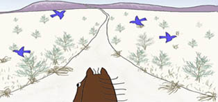
. If you walk, ride a horse or mountain bike on many of the local dirt roads you see magnificent views of Cahuilla, Thomas, and Beauty Mountains which embrace the Anza Valley. The newly incorporated nonprofit wants these views to be seen from common trails that will enhance the community’s leisure and pleasure...
Read more here:
http://anzavalleyoutlook.com/local/anza-area-trail-town-committee-becomes-nonprofit-corporation/
Wednesday, July 5, 2017

Saturday, July 1, 2017
Great Shasta Rail Trail: a link to history in northern California
 AmericanTrails.org
From Great Shasta Rail Trail Association
The Great Shasta Rail Trail follows the route of the eastern expansion of the McCloud River Railroad, stretching across 80 miles of the natural and human history of the west. The town of McCloud, at the western end of the trail, sits on the southern flank of Mount Shasta, an isolated volcanic peak rising 14,162 feet above sea level. Along the route, there are dense stands of timber, which drew loggers and early settlers.
As the logging industry drew the railway east and south, camps, villages, and towns sprang up along the route until the railroad reached the vast timber resources surrounding Burney, the southern terminus. Though the railroad is gone, the towns remain. The story of the railroad still connects these communities, and will come alive again through the Great Shasta Rail Trail.
In 2005, McCloud Railway Company (MCR) petitioned the Surface Transportation Board (STB) to abandon their 80-mile rail line between Burney and McCloud, California. In March, 2009, individuals interested in converting the entire 80-mile rail line (over 1,000 acres) into a trail formed a trail coalition. There was broad based community support for development of the proposed trail from local businesses and organizations, State and Federal agencies, land trusts, and individuals.
A Core Team of non-profit organizations was composed of the Shasta Land Trust, Volcanic Legacy Community Partnership, McCloud Local First Network, and Ventura Hillsides Conservancy. The Core Team completed a draft “Trail Feasibility Study,” which describes the social and economic values of converting the corridor to public trail purposes. The Great Shasta Rail Trail Association (GSRTA) will lead detailed planning efforts, trail development, maintenance work, interpretative, and stewardship efforts.
On November 23, 2009, SBF petitioned the STB for issuance of a “Notice of Interim Trail Use” (NITU). On December 3, 2009, MCR agreed to negotiate a “rail banking” Purchase Agreement for their 80-miles of rail line. On December 28, 2009, STB accepted and granted SBF’s request of NITU.
The completed recreational trail will provide numerous benefits to the rural communities of Burney and McCloud, as well as to adjacent property owners. Many studies have shown that recreational trails stimulate tourism and recreation-related spending, increase property values, and attract new businesses, which all benefit local economies.
Greater opportunities for outdoor exercise and recreation will improve the quality of life and health benefits for Shasta and Siskiyou County residents and tourists. GSRT will provide an invaluable link between Burney, McCloud, and McArthur-Burney Falls Memorial State Park. It will also connect with the Pacific Crest National Scenic Trail and recreation facilities on adjacent national forest land. GSRT is envisioned as a shared-use trail, providing opportunities for hiking, biking, equestrian use, cross-country skiing, and possibly motorized trail uses such as winter snowmobiling.
In addition to increased opportunities for recreation and tourism, GSRT will also protect important natural resources and scenic amenities in northern California. The corridor offers almost innumerable possibilities for scenic overlooks and access to several streams, rivers, falls, and lakes for camping, picnicking, and fishing. It will provide access to hunting areas as well as opportunities for wildlife viewing and plant study. The trail will serve as a long-term fire break and critical access for emergency fire suppression. It will protect several historical sites and provide a new venue for community events to stimulate local economies through tourism and fund raisers.
In February 2013, a workshop brought together members of the San Francisco and Sacramento Chapters of the American Society of Landscape Architects, and Great Shasta Rail Trail volunteers to create design concepts for the trail. The workshop involved an overview of the proposed trail, outlining regional and cultural history, user needs, and goals for the project, with special focus on the locations of identified trailheads and the region’s natural resources and topography.
The trail will echo the route of the rail line and, although the rails have been removed, its sinuous journey through the Sierra–Cascade landscape remains. Most of the trail surface will be compacted volcanic cinder and at least eight feet wide, but near access points and communities, it is envisioned that the trail will be a hard surface to provide for accessibility. Where feasible within the corridor, an equestrian trail will parallel the pedestrian–bike trail, either on the trail shoulder or as a separate trail. Motorized use will be limited to areas where existing uses cross the trail corridor.
For more information and maps, see:
http://www.americantrails.org/resources/railtrails/Great-Shasta-Rail-Trail-CA.html
Wednesday, June 28, 2017
Administration Budget Decimates Trails Funding - You Can Help
June 26 2017
Sign on Your Organization to Protect Trails
Hello Trail Partners,
The Administration's proposed budget for fiscal year 2018 reveals what are nothing less than catastrophic cuts to programs that directly impact trails and the places where Americans hike and enjoy the outdoors. The proposed budget for trails and the federal agencies that manage and maintain trails on federal lands fails to provide for even the most basic necessities needed to maintain and manage these critical recreation resources.
We are stronger when we stand together.
A sign-on letter was carefully crafted in partnership with the American Hiking Society, Backcountry Horsemen of America, and the Partnership for the National Trails System, reflecting the level of concern among all trail user groups. If your organization is as shocked at the Administration's proposed budget as most of us who support trails, outdoor recreation, and public lands, we ask that you add your organization's name to the sign-on letter which will be provided to the appropriators and other members of Congress.
If you are a partner organization, please sign on to this letter. If not, please share this with your favorite organizations including those who are not trails-specific but that advocate for things such as public health, business, and outdoor recreation.
Sign on now:
https://americanhiking.org/advocacy/support-trails-funding-in-2018-federal-budget/
Sign on Your Organization to Protect Trails
Hello Trail Partners,
The Administration's proposed budget for fiscal year 2018 reveals what are nothing less than catastrophic cuts to programs that directly impact trails and the places where Americans hike and enjoy the outdoors. The proposed budget for trails and the federal agencies that manage and maintain trails on federal lands fails to provide for even the most basic necessities needed to maintain and manage these critical recreation resources.
We are stronger when we stand together.
A sign-on letter was carefully crafted in partnership with the American Hiking Society, Backcountry Horsemen of America, and the Partnership for the National Trails System, reflecting the level of concern among all trail user groups. If your organization is as shocked at the Administration's proposed budget as most of us who support trails, outdoor recreation, and public lands, we ask that you add your organization's name to the sign-on letter which will be provided to the appropriators and other members of Congress.
If you are a partner organization, please sign on to this letter. If not, please share this with your favorite organizations including those who are not trails-specific but that advocate for things such as public health, business, and outdoor recreation.
Sign on now:
https://americanhiking.org/advocacy/support-trails-funding-in-2018-federal-budget/
Tuesday, June 20, 2017
2018 is the National Trails System's 50th Anniversary
 Trails50.org
It's the National Trails System's 50th Anniversary
And you're invited to the party!
In 2018, America will be celebrating the 50th anniversary of our National Trails System but the party is already underway! Join the celebration by sharing your stories, photos, or favorite memories, or by simply getting out on the trail – and maybe bringing along a friend.
With the passage of the National Trails System Act in 1968, America was given a gift – the creation and protection of some of Americans’ favorite places to discover the great outdoors. Trails that celebrate outdoor adventure such as the Appalachian Trail and trails that allow us to walk through history, such as the Selma to Montgomery National Historic Trail.
So, join the conversation on Facebook, Twitter, or right here on our website dedicated to this tremendous nationwide celebration of trails and all the places they allow us to explore. Share your love of trails and the outdoors. Go ahead – wear your heart on your sleeve – or on your backpack: this is a time of celebration.
While you're here, please take a moment and sign up to get email updates to find out what's going on in your neck of the woods as well as get key updates to the 50th.
Share your favorite trail photos, sign up, and more, at:
https://www.trails50.org/
Tuesday, June 13, 2017
Horsepower: where it all started
 Americantrails.org - Full Article
Horsepower. The term oozes petroleum, big diesel pickups, Harley’s and cut-off flannel shirts in the garage. In an age where television is riddled with ads for vehicles boasting “the most” and “the strongest,” we often forget where it all start- ed from; the horse.
By definition, horsepower is what it takes to lift 33,000 lbs one foot in height over the course of one minute. A healthy human can sustainably produce approximately one tenth of one hp, not very much by any standard when the big trucks on television tout 300-500 horsepower.
Now contrast that to designated Wilderness areas where motors are no longer allowed and the options for accomplishing work and moving equipment are limited to either human power or horsepower. Moving downfall off the trail, digging new tread, and building turnpikes are examples of work that must be done without the assistance of motors.
In order to accomplish many of these tasks, backcountry managers use horses and mules. While livestock can’t pull a crosscut or swing an axe, they can provide the needed torque to move heavy objects around in the backcountry.
The majority of the gear necessary to work and recreate in the Wilderness is packed in on the backs of horses and mules. However, what most people don’t see is the work that was done and still continues to occur using mule teams to drag and skid objects...
Read more here:
http://www.americantrails.org/resources/horse/horsepower-mule-trail-plow.html
A Public Land Manager on How Americans and Their Federal Government Can Work Together
 Outdoorlife.com - Full Article
Tim Love was a Forest Service District Ranger for 20 years. This is his perspective on our public lands
By Alex Robinson
June 8, 2017
In January, Utah Representative Jason Chaffetz introduced a bill that would eliminate the jobs of U.S. Forest Service and Bureau of Land Management rangers. The idea behind the bill is that local law enforcement could do a better job policing than the feds. The sentiment that federal agencies are overreaching their responsibilities on massive tracts of public land in the West played out in a dramatic standoff the previous year when an armed militia seized the Malheur National Wildlife Refuge in Oregon and demanded the federal government relinquish control of the 187,000-acre refuge.
Chaffetz’s bill and the Malheur takeover captured national media attention, painting a picture of stark conflict between local westerners and federal land managers.
But as Tim Love tells it, this sort of heated contention is the exception, not the rule.
Love was the U.S. Forest Service district ranger for the Seeley Lake area of the Lolo National Forest in northwestern Montana for 20 years. He was in charge of managing 400,000 acres for outdoor recreation, wildfire management, wildlife habitat, and timber harvest until he retired in November 2014. Because he is retired, Love can speak freely about the Forest Service.
Love admits there are real problems facing federal land and challenges for those trying to manage it. But according to Love, the solutions to those problems include simplifying regulations and working closely with the community—not extreme measures like transferring lands to the states or stripping away agency budgets...
Read more here:
http://www.outdoorlife.com/public-federal-land-manager-on-how-to-work-together?6coBlJK7RWMkDTYW.03
Tuesday, June 6, 2017
ELCR and USDF Launch the Equine Land Conservation Achievement Award
Lexington, KY – June 5, 2017 – Equine Land Conservation Resource (ELCR), in partnership with the United States Dressage Federation (USDF), is pleased to announce the inaugural Equine Land Conservation Achievement Award. Nominations for the award, which recognizes an individual or organization for outstanding achievement in protecting land or access to land for equine use, will be due by August 31, 2017. Nomination forms may be found on the USDF website at: https://www.usdf.org/awards/service/. Winners will be notified by October 1, 2017.
“USDF is very pleased to partner with ELCR on this award to help increase awareness of the importance of land conservation in the dressage community and to serve as inspiration to others within our discipline,” said USDF Executive Director, Stephan Hienzsch.
USDF’s Regional Group Membership Organizations (GMO) have been asked to consider individuals, organizations and agencies familiar to them, which are related to dressage and their communities, and to nominate those persons or entities which have accomplished exceptional achievements in the area of equine land or facilities protection or enhancement, especially at the local level, along with those activities that may have nationwide impacts.
The award will be presented at the Adequan/USDF Annual Convention awards ceremony on Saturday, December 2, 2017 in Lexington, KY. Convention and awards ceremony information may be found at: www.usdf.org/Convention.
“We are delighted to present the Equine Land Conservation Achievement Award in partnership with USDF, one of our long standing Conservation Partners. We look forward to recognizing and celebrating many future conservation achievements with the dressage community,” said ELCR Executive Director, Holley Groshek.
For additional information, contact:
Denise Y. O’Meara, Director of Education
Equine Land Conservation Resource
Phone: 859-455-8383
Email: domeara@elcr.org
www.ELCR.org
“USDF is very pleased to partner with ELCR on this award to help increase awareness of the importance of land conservation in the dressage community and to serve as inspiration to others within our discipline,” said USDF Executive Director, Stephan Hienzsch.
USDF’s Regional Group Membership Organizations (GMO) have been asked to consider individuals, organizations and agencies familiar to them, which are related to dressage and their communities, and to nominate those persons or entities which have accomplished exceptional achievements in the area of equine land or facilities protection or enhancement, especially at the local level, along with those activities that may have nationwide impacts.
The award will be presented at the Adequan/USDF Annual Convention awards ceremony on Saturday, December 2, 2017 in Lexington, KY. Convention and awards ceremony information may be found at: www.usdf.org/Convention.
“We are delighted to present the Equine Land Conservation Achievement Award in partnership with USDF, one of our long standing Conservation Partners. We look forward to recognizing and celebrating many future conservation achievements with the dressage community,” said ELCR Executive Director, Holley Groshek.
For additional information, contact:
Denise Y. O’Meara, Director of Education
Equine Land Conservation Resource
Phone: 859-455-8383
Email: domeara@elcr.org
www.ELCR.org
Subscribe to:
Posts (Atom)