KRTV.com - Full Article
Governor Steve Bullock hosted state leaders and outdoor groups in Helena on Monday to officially kick off a new program to expand access to public lands in Montana.
Posted: Dec 18, 2017 10:41 PM
Updated: Dec 18, 2017 9:46 PM PST
By: Jonathon Ambarian - MTN News
The Montana Public Land Access Network, or MT-PLAN, will collect private donations from individuals and groups.
That money will then be offered as grants to landowners who open access through their property to public lands that aren’t otherwise accessible or who improve existing public access.
The Montana Department of Natural Resources and Conservation will administer MT-PLAN and make recommendations on grant applications. The projects must then be approved by the state Land Board.
Bullock pointed to a study by the Center for Western Priorities, which found Montana has nearly two million acres of public lands that are currently inaccessible for recreation.
“This network will allow Montanans, each and every one of us, to help further chip away at those two million acres and unlock more areas of public lands for all of us to enjoy,” he said...
Read more here:
http://www.krtv.com/story/37096142/state-leaders-and-outdoor-groups-launch-new-public-land-access-program
Wednesday, December 20, 2017
Monday, December 18, 2017
Winter Riding: Anza Borrego, California
Trailmeister.com - Full Article
This place is big. Really big. Covering 916 square miles Anza Borrego State Park is the largest state park in California and the second largest state park in the entire US. The park includes 12 wilderness areas, 500 miles of gravel roads and over 100 miles of designated trails. And at only two hours from the cities of San Diego and Riverside it’s easy to get to.
The park is named for Juan Bautista de Anza, a Spanish explorer from the late 1700’s and the Spanish word borrego, or bighorn sheep. Portions of the 1,210-mile-long Juan Bautista de Anza National Historic Trail run through the park as it travels from Nogales, AZ to San Francisco, CA. Anza Borrego is also home to the largest number of endangered Peninsular Bighorn Sheep in California. About 280 of these magnificent animals remain and 200 of those call Anza Borrego home. Riders with sharp eyes may also catch a glimpse of speedy roadrunners and graceful golden eagles...
Read more here:
https://www.trailmeister.com/trailmeisters-top-horse-trails-winter-riding-opportunities-in-california-north-carolina-and-washington/?utm_source=MailingList&utm_medium=email&utm_campaign=DEC+2017+mid+month+newsletter
Wednesday, December 13, 2017
Podcast: Nat'l Forest Service Trails Bill Discussed on Equestrian Legacy Radio
BlogTalkRadio.com - Listen in
Listen to the podcast with BCHA Jim McGarvey, Jaime Schmidt & Deb Caffin with USFS. Jaime is the National Program Manager for Trails and the one AERC signed the MOU with. Deb Caffin is the Recreation Program Manager for Trails Region 8. They talk about implementation of the National Forest System Trails Stewardship Act that was passed last year.
Listen to the podcast with BCHA Jim McGarvey, Jaime Schmidt & Deb Caffin with USFS. Jaime is the National Program Manager for Trails and the one AERC signed the MOU with. Deb Caffin is the Recreation Program Manager for Trails Region 8. They talk about implementation of the National Forest System Trails Stewardship Act that was passed last year.
Thursday, December 7, 2017
The Fight for Public Land in Montana's Crazy Mountains
 Outsideonline.com - Full Article
Christopher Solomon
Dec 6, 2017
In the last 18 months, long-simmering disputes have boiled over amid claims of trespassing, political meddling, government bullying, and retaliation. Some worry that what’s happening there may harbinger what’s to come on public land across the nation. It’s enough to call the situation, well, you know.
In the fall of 2016, Rob Gregoire, a hunter and nearly life-long Montanan, won a state lottery for a permit to take a trophy elk in the Crazy Mountains, which rise from the plains about 60 miles north of Yellowstone National Park. Landowners around the mountains were charging about $2,000 for private hunts on their ranches. “That’s just not what I do, on principle,” Gregoire says. So he found a public access corridor that would take him into prime Crazies elk country—the federal land covered by the permit, which in total cost about $40.
Such trails have led into the Crazies for generations. And disputes between landowners and those who would cross their properties on these trails reach back nearly that far, too. By 2016, the trailhead Gregoire found was “the last non-contested public access point on the 35-mile-long eastern flank of the Crazy Mountains,” he would write later to his U.S. senators.
Yet even on what Gregoire thought was a public throughway, the Hailstone Ranch had posted game cameras and signs claiming that the Forest Service didn’t have an easement to use the segment that crossed the private property. After consulting with the Forest Service, Gregoire was convinced he had the right to hike the route. Once on it, he used an app to stay on trail where it seemed faint, to make sure he kept to public land. Then one evening as he returned toward the trailhead after an unsuccessful hunt, Gregoire found a deputy sheriff from Sweet Grass County waiting for him. The deputy handed Gregoire a ticket for criminal trespass. After court costs, the ticket cost $585...
Read more here:
https://www.outsideonline.com/2263356/crazy-mountains
Wednesday, December 6, 2017
Apply for a Grant from the National Trails Fund - Starting January 15, 2018
AmericanHiking.org
Does your organization want to complete a trail project but lack the funding to do so? American Hiking Society will be accepting applications for National Trails Fund grants for amounts between $500 and $3,000 thanks to the generosity of L.L.Bean. The application period will end on February 15.
The National Trails Fund benefits Alliance of Hiking Organizations, American Hiking Society's network of trail organizations that build and maintain America's foot trails.
American Hiking Society’s National Trails Fund offers Micro-Grants to active organizations of our Alliance of Hiking Organizations. Once a year, Alliance Organization Members have the opportunity to apply for a Micro-Grant (value between $500 and $3,000) in order to improve hiking access or hiker safety on a particular trail. If your organization is interested in applying, but is not yet an Alliance Organization Member sign up here.
American Hiking Society’s National Trails Fund is the only privately funded, national grants program dedicated solely to building and protecting hiking trails. Created in response to the growing backlog of trail maintenance projects, the National Trails Fund has helped hundreds of grassroots organizations acquire the resources needed to protect America’s cherished hiking trails. To date, American Hiking Society has funded 217 trail projects through 170 organizations by awarding over $698,000 in National Trails Fund grants.
For more information, see:
https://americanhiking.org/national-trails-fund/
Tuesday, December 5, 2017
The Public-Land Bills We Can All Agree On
Outsideonline.com - Full Article
Two bipartisan bills show how the left and the right can converge on public land policy
Jake Bullinger
Dec 4, 2017
It would seem Republicans and Democrats are wholly divided on public land policy. During the 2016 campaign, the GOP platform called on Congress to “immediately pass universal legislation” to “convey certain federally controlled public lands to states,” while Democrats sought “policies and investments that will keep America’s public lands public” by prioritizing access and environmental safeguards.
But, believe it or not, some consensus exists. A pair of bills introduced this year—including one that would make it easier to transfer federal land to states—shows that Republicans and Democrats can actually agree on certain aspects of public land management.
The land transfer bill, dubbed the Advancing Conservation and Education Act, was introduced on November 6 in the House by Chris Stewart, a Utah Republican, and Jared Polis, a Colorado Democrat. An identical measure in the Senate is backed by Democrat Martin Heinrich of New Mexico and Arizona Republican Jeff Flake. The bill would allow western states to ask the Department of the Interior to swap state-held trust lands surrounded by federal conservation plots for federal parcels that are easier to develop...
Read more here:
https://www.outsideonline.com/2266181/public-land-isnt-just-fighting
Monday, December 4, 2017
A Private Landowner Almost Cut Off the PCT
David Ferry
Nov 29, 2017
The association that manages the West's premier national trail just paid $1.6 million to prevent a property owner from putting up a fence 150 miles shy of the Canadian border
In January 2015, the Pacific Crest Trail Association received a letter from the owner of a 402-acre plot of land near Stevens Pass, roughly 75 miles east of Seattle. The landowner, a family trust, held one of the few remaining privately held patches of the Pacific Crest Trail—a parcel that thousands of Washingtonians use each year to reach alpine wilderness areas and thru-hikers traverse on their way up to the northern terminus at Manning Park. The family trust, the letter said, wanted to sell.
It was good news for the PCTA, a nonprofit that’s been laboring to preserve and protect the 10 percent of the long-distance trail that, surprisingly, still sits in private hands. But the landowner, who remains anonymous, wanted to play hardball. The trust had divvied up the plot, which lies near the popular Stevens Pass ski area, into 16 different parcels, and according to a memo put together by the trust’s real estate adviser, the zoning meant a prospective buyer could build up to 748 dwellings in the pristine Cascade wilderness along the trail. Even more worrying, the letter made clear that the trust was willing to erect a fence across the section of the PCT that crossed its property, bisecting the trail 150 miles short of the border.
“For us, not only was it a big threat they could close the trail,” says Megan Wargo, director of land protection at the PCTA, “but we had done some fieldwork to look at what it would take to reroute the trail. It wasn’t just a simple loop around; it would have taken an extensive reroute to get around some serious topography. It would have had a significant impact on people’s ability to do a thru-hike.” Wargo estimates it would have taken a year to reroute the trail.
The PCT gets severed all the time, usually due to wildfires or the occasional newly discovered endangered species ecosystem on the route. But the threat to the Stevens Pass section of the trail underscores the little-known threat from private developers faced by the PCT and other long-distance trails...
Read more here:
https://www.outsideonline.com/2264601/private-landowner-almost-cut-pct?utm_medium=email&utm_campaign=Dispatch-11302017&utm_content=Dispatch-11302017+Version+A+CID_d29c2ffec494d26a7c7cc44a090a7f7e&utm_source=campaignmonitor%20outsidemagazine&utm_term=READ%20MORE
Saturday, December 2, 2017
How states generate money from the land they own
HCN.org - Full Article
From Arizona to Oregon, states have different tactics to make money off their state trust lands.
Anna V. Smith ANALYSIS Nov. 27, 2017
When Western states joined the Union, the federal government granted them parcels of land in order to provide sustained revenue for public institutions, primarily schools, and to spread democratic ideals in the growing region. Older states, such as California and Oregon, have little acreage left today because they quickly sold off their “trust lands” to generate money — a move that clashed with the federal government’s long-term vision for those lands. So when newer states like Arizona and New Mexico received their trust lands, the federal government, and sometimes the states themselves, placed restrictions on sales, such as minimum prices. Today, these states retain much of their original acreage, and generate money primarily by leasing parcels to developers and the extractive industry. There are 46 million acres of state trust land in the U.S., most of it in the West. Here’s a look at the different approaches Western state take to these lands...
Read more here:
http://www.hcn.org/issues/49.20/infographic-how-states-generate-money-from-trust-lands?utm_source=wcn1&utm_medium=email
Wednesday, November 29, 2017
Colorado: Forest seeks comments on Boggy Draw trail plan
 The-Journal.com - Full Article
By Jim Mimiaga Journal Staff Writer
Tuesday, Nov. 28, 2017
The Dolores Ranger District is accepting public comments on a preliminary environmental assessment for the Boggy Draw Trails expansion project.
The project would add about 25 miles of nonmotorized trails to the trails system, north of Dolores. The area currently includes 20 miles of motorized trails and 35 miles of nonmotorized trails.
The environmental assessment is available for public review and comment at: bit.ly/Boggytrails...
Read more here:
https://the-journal.com/articles/75924
Tuesday, November 28, 2017
In Utah, public access to state lands comes at a cost
HCN.org - Full Article
Public access to trust lands varies widely from state to state.
Emily Benson Analysis Nov. 27, 2017
How much is hunting and fishing access to 3.4 million acres of land in Utah worth? Last year, the answer was $776,000. That was the amount the Utah Department of Natural Resources paid another state agency, the School and Institutional Trust Lands Administration (SITLA), to secure public access to state trust lands, granted to Western states by the federal government to generate money for schools and other public institutions.
This fall, however, the deal between the Natural Resources Department and SITLA expired. In negotiating its renewal, SITLA wanted to raise its fee to market rates, estimated at $1.8 to $3.9 million a year for the 1 million acres that have commercial hunting value. If the department didn’t pay up, SITLA seemed ready to lease exclusive access to beloved places like the Book Cliffs — a vast wilderness of rugged bluffs and forested valleys teeming with elk, mule deer and cutthroat trout — to wealthy hunters. Access to prime areas would be scooped up mainly by customers willing to pay thousands of dollars for a single hunt, with only a handful of permits issued through a public lottery.
Kim Christy, SITLA’s deputy director, argued that the agency was merely fulfilling its obligation under the state Constitution to optimize revenue. But many sportsmen saw it differently. Bill Christensen of the Rocky Mountain Elk Foundation says access to state lands shouldn’t be reserved for the highest bidders. And SITLA’s demands underscored his fears about what could happen should federal lands be transferred to state control: privatization and loss of access...
Read more here:
http://www.hcn.org/issues/49.20/public-lands-in-utah-public-access-to-state-trust-lands-come-at-an-increasing-cost
Sunday, November 19, 2017
Breaking Down the Silos - Bridging the barriers between trail user groups
 AmericanTrails.org - Full Article
American Trails exists to help the trails community to communicate, share information, and work together to build the strength of our message that trails move the world.
Toward that end, American Trails introduces an ongoing series called “Breaking Down the Silos,” where we discuss the happenings and ideas that help to bridge the barriers between the different trail user groups and bring all members of our trails community together to ensure positive change in our trail world.
Mike Passo, American Trails’ executive director, recently attended the National Off-Highway Vehicle Conservation Council (NOHVCC) Conference in Manchester, NH.
“It was a truly superb event,” Mike said. “While there, I learned a lot about what moves the motorized trail community, what their struggles are, and how other constituency groups can work with NOVHCC.”
Mike hosted an American Trails Town Hall listening session as a part of the conference, and over the course of the weekend, heard several themes emerge around the motorized trail community and its relationship to the rest of the trails world. Below is a synopsis of the themes that arose:
There is a need for a common message that ALL trail constituencies can rally behind. As a coalition of trail organizations, we can develop agreed-upon goals and messaging and promote that vigorously for the betterment of trails as a whole...
Read more here:
http://www.americantrails.org/views/Bridging-barriers-trail-users-Mike-Passo.html
Saturday, November 18, 2017
How to Help Keep Horse Trails Open – California's Reyes Creek Horse Camp
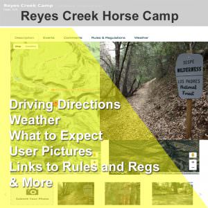 Trailmeister.com - Full Article
July 3 2017
by Robert Eversole
Paradise. For some that’s an image of a tropical beach, for me, it’s a dirt trail that twists and meanders to a backcountry camp deep in the wilderness. It’s a quiet solitude punctuated by the peaceful clip clop of hooves and the far scream of an eagle aloft. It’s the sweet perfume of pine on a warm summer day. It’s the companionship of a trusted horse who will faithfully take you home.
Unfortunately, in a growing number of cases paradise is padlocked.
In only a few short generations we’ve “improved” a lot of backcountry and rural areas into suburbia and shopping malls. Trail Closed signs are both dreaded and unfortunately frequently encountered. Least we lose them, we’d better take care of the equine friendly country that remains. Paradise needs protecting.
You don’t have to be a trail rider, or even have your own horse, to recognize the importance of conserving horse trails. There are many things that each of us can do to preserve equine trails. Here’s one easy thing that you and I can do to help keep our trails open.
Avoid Wet Trails
I count this under the headings of both good stewardship and good relations with other trail users.
Rain will be in the forecast. Throughout the spring season, trails tend to be more saturated and hold more water, sometimes taking days to dry. Simply put, if mud or wet trail is sticking to your shoe or your horse’s shoes, you should turn around.
I understand that “stuff” happens. Through either bad circumstance or poor judgment, we’ve all found ourselves in situations and on trails we shouldn’t have been on. I‘m not here to place blame, or be a trail Nazis, but simply to spread awareness and encourage everyone to be considerate trail users. After all, these are our trails, paid for largely by our tax dollars, donations, and volunteer labor. It’s up to us to protect and sustain them for years to come.
Here are two reasons not to ride wet trails...
Read more here:
https://www.trailmeister.com/how-to-help-keep-horse-trails-open-reyes-creek-horse-camp/?cat=1
Friday, November 17, 2017
Bikes and horses: changing attitudes

An exercise to sensitize bikers to horses and horses to bikes; photo from Black Hills Trails
AmericanTrails.org - Full Article
By Kerry Greear
Six years ago, my friend Lori Johnson and I were riding our horses on public land near my home on a perfect Saturday in June. After saddling our horses, we led them toward a gate and experienced our first interaction of the day: a mountain biker who was getting ready to go on a ride with his children.
The biker was rather abrasive and complained about equestrians damaging trails when they are wet, expecting bikers to stop and get off the trail, and generally causing aggravation. Lori and I were nice to them, our horses were well behaved, and I left with a comment about all of us getting along and getting to know each other better.
Our second and third interactions with bikers on “our trails” were equally negative. The following weekend I talked with my son, who is a mountain biker, about the possibility of changing attitudes and learning more about each other. And I hatched a plan.
The following month a mountain bike race was scheduled near Sturgis, SD, near my home. With a copy of the ride map, my horse Hawk and I were ready at mile 20 to get behind the last rider and “sweep.” I picked up GU containers, lost water bottles, and a few parts lying along the trail.
Ten miles later, I found an injured woman in an area with no cell phone service. After making sure she was okay, I helped her mount Hawk and pushed and rode her bike down the trail until she could call her family. I took her to a place they could pick her up along with her bike. I continued on and at the finish line received a substantial standing ovation... and many thanks for the trash and parts I’d picked up along the trail.
After that, I noticed a slight thawing of attitudes when I met mountain bikers out on the trail....
Read more here:
http://www.americantrails.org/resources/horse/Bikes-horses-changing-attitudes.html
New Mexico: County Commission OKs plan for Thornton Ranch trail system
 ABQJournal.com - Full Article
By T. S. Last / Journal Staff Writer
Published: Friday, November 17th, 2017 at 12:02am
SANTA FE, N.M. — It’s been a long time coming and will take a few more years. But public access to some of the most scenic, historic and culturally significant acreage in Santa Fe County is on the way now that the County Commission approved the master plan for Thornton Ranch Open Space.
The action paves the way for an expanded trail system that can be used by hikers, mountain bikers and horseback riders, and an educational hub augmented by interpretive signs to introduce visitors to the site. Public access could come as soon as 2021.
The master plan, as well as a management plan for the space, was approved by the County Commission earlier this month, along with management plans for Petroglyph Hill and the Galisteo Basin Interpretive Plan.
“We’ve been working on how we’re going to manage this property for a long time,” Colleen Baker, project manager with Santa Fe County, said of the 2,430 acres in the heart of the Galisteo Basin about 15 miles southeast of Santa Fe. “It’s really the culmination of a coordinated effort to bring all four of these plans together.”
While increasing access is part of the plan, “first and foremost, it’s for the protection of cultural resources – then to provide meaningful public access,” she said.
Central among the cultural resources is Petroglyph Hill, a basalt-capped volcanic outcrop featuring more than 1,800 images etched into the rock by indigenous people, some believed to be thousands of years old, but most carved by pueblo people who resided in the Galisteo Basin, in the short-lived Burnt Corn Pueblo in particular...
Read more here:
https://www.abqjournal.com/1094115/county-commission-oks-plan-for-thornton-ranch-trail-system-ex-public-access-to-the-area-in-the-galisteo-basin-could-come-as-soon-as-2021.html
Monday, November 13, 2017
New Mexico: Sabinoso Wilderness opens to public Friday after long delay
 ABQJournal.com - Full Article
By Michael Coleman / Journal Washington Bureau
Thursday, November 9th, 2017 at 7:16pm
The Sabinoso Wilderness in northern New Mexico will finally become accessible to the general public beginning at noon today (Friday, Nov. 10).
The U.S. Interior Department announced late Thursday that the pristine habitat for elk, mule deer, and other wildlife is for the first time accessible to the public for hunting, fishing, and other recreational activities. The 16,000-acre Sabinoso had been surrounded by non-federal land, making it inaccessible to the general public.
The private donation of 3,595 acres formerly known as the Rimrock Rose Ranch adjacent to the Wilderness was accepted by Interior Secretary Ryan Zinke, and will allow for the public access. Click here for New Mexico’s hunting rules and regulations.
“I’m happy to announce today the Sabinoso Wilderness Area is finally open and accessible to hunters and all members of the public for the first time ever,” Zinke said.
The rugged and remote wilderness area is east of Las Vegas in San Miguel County in northeastern New Mexico. The Sabinoso Wilderness boasts some of the most pristine elk habitat in the country. Zinke had previously voiced concerns about accepting the donated ranch as wilderness itself and whether there should other kinds of access beyond on foot or horseback...
Read more here:
https://www.abqjournal.com/1090591/sabinoso-wilderness-opens-to-public-friday-after-long-delay.html
Saturday, November 11, 2017
New Mexico: Thornton Ranch area to open for public access
SantaFeNewMexican.com - Full Article
Tripp Stelnicki | The New Mexican Nov 6, 2017 Updated Nov 7, 2017
Santa Fe County has finalized a long-awaited plan to open up almost 2,500 picturesque acres in the heart of the Galisteo Basin.
Hikers, bikers, outdoor explorers and horseback riders will soon be able to enjoy the Thornton Ranch Open Space. New trails will be built, and much of the “culturally sensitive” land and archaeological resources in the scenic conservation area 15 miles southeast of Santa Fe are to be improved or restored.
The Thornton Ranch master plan was approved last week to applause by county commissioners. They also authorized an interpretive plan for the Galisteo Basin and a management plan for Petroglyph Hill, a small volcanic summit that is sacred to Native tribes and was designated for protection by Congress in 2004.
These documents will together guide the public use and management of what is the county’s largest open space, with 360-degree mountain views and immaculate night skies.
“There’s been an attack in other parts of the country associated with our public lands and many areas that are saying they want to give them back,” said Commissioner Robert Anaya, referring to U.S. Interior Secretary Ryan Zinke’s recommendations that at least four national monuments be shrunk. “That couldn’t be further from what we really need. What we need is to continue to have projects like this...”
Read more here:
http://www.santafenewmexican.com/news/local_news/thornton-ranch-area-to-open-for-public-access/article_b4cb6b4f-105f-5155-89e9-7526aaee5ba9.html
Monday, November 6, 2017
Why You Don't Want the States Managing Public Land
Outsideonline.com - Full Article
The GOP doesn't think the feds should oversee our national heritage. Here's why they're wrong.
Wes Siler
Nov 2, 2017
States should manage the public lands within their own borders, right? It sounds like one of those common sense, local management, small government things that will be in the citizens’ best interests.
It’s actually exactly the opposite.
That's because the federal government is mandated to manage public lands for multiple uses. So for-profit enterprises, like logging and drilling, need to co-exist with folks who want to hike, bike, and play on those lands, as well as the wildlife that already lives there. In contrast, states are mandated to manage their lands for profit, which means logging and drilling take precedent over public access and environmental concerns.
The difference really is that simple, and it's really all you need to know to understand why federal management is better for our wild places than state management. But the ramifications of that difference are incredibly far reaching...
Read more here:
https://www.outsideonline.com/2256531/why-you-dont-want-states-managing-public-land
Top Trail Picks – Nov 2014 – CT, NE, OR
December 22, 2014
November is one of my favorite month’s of autumn when the horse riding and camping trips can vary between encounters Indian Summer’s warm breezes and glorious golden leaves to bitterly cold sheets of driving rain that drives us indoors to the welcome warmth of a fire. It’s a month of change as we move into winter.
Let’s embrace November and the changing of the seasons with visits to three wonderful horse riding and camping areas with names starting with the letter N. This month we’ll again travel coast to coast; starting on the eastern Atlantic seaboard in Connecticut then traveling 1,600 miles due west to the rolling sand hills of Nebraska, then continuing further westward another 1,500 miles to the Pacific coast of Oregon...
Read more here about
Natchaug State Forest – Ashford, Connecticut
Natick Horse Camp – North Platte, Nebraska
Nehalem Bay State Park – Manzanita, Oregon
https://www.trailmeister.com/top-trail-picks-nov-2014-ct-ne-or/?utm_source=MailingList&utm_medium=email&utm_campaign=Nov+2017+general+newsletter
Sunday, November 5, 2017
Montana: This Land Is No Longer Your Land
Bloomberg.com - Full Article
The fight over preserving public land during the Trump era is taking a strange, angry twist in Montana’s Crazy Mountains. Both sides are armed.
By Monte Reel
Brad Wilson is following a forest trail and scanning the dusky spaces between the fir trees for signs of movement. The black handle of a .44 Magnum juts prominently from his pack. If he stumbles on a startled bear at close range, the retired sheriff’s deputy wants to know the gun is within quick reach, in case something stronger than pepper spray is needed. Wilson isn’t the type who likes to take chances; he’s the type who plans ahead.
Before setting foot on this path, he unfolded a huge U.S. Forest Service map and reviewed the route, Trail 267. He put a finger at the trailhead, which was next to a ranger’s station, then traced its meandering path into the Crazy Mountains, a chain in south-central Montana that’s part of the northern Rockies. Like many of the trails and roads that lead into U.S. Forest Service land, Trail 267 twists in and out of private properties. These sorts of paths have been used as access points for decades, but “No Trespassing” signs are popping up on them with increasing frequency, along with visitors’ logs in which hikers, hunters, and Forest Service workers are instructed to sign their names, tacitly acknowledging that the trail is private and that permission for its use was granted at the private landowners’ discretion.
Wilson hates the signs and the logbooks, interpreting them as underhanded attempts by a handful of ranchers to dictate who gets to enter federal property adjacent to their own. Several of the owners operate commercial hunting businesses or rental cabins; by controlling the points of ingress to public wilderness, Wilson says, they could effectively turn tens of thousands of acres of federal land into extensions of their own ranches. That would allow them to charge thousands of dollars per day for exclusive access, while turning away anyone—hikers, anglers, bikers, hunters, locals like Wilson, or even forest rangers—who didn’t strike a deal...
Read more here:
https://www.bloomberg.com/news/features/2017-10-25/this-land-is-no-longer-your-land
Monday, October 30, 2017
Canada: Horseback riders lose bid for access to DCF Main Tract
Citizen.on.ca - Full Article
October 27, 2017
By Mike Pickford
What appears to be a longstanding, bitter feud between two different user groups of the Dufferin County Forest reared its head last Thursday as County Council heard from horseback riders who feel hard done by recent changes to the recreational policy for the site.
It was a busy night inside council chambers as people on both sides of the issue filled the gallery, with the horse riders especially vocal as they sought to change a new policy, implemented in May, that the County spent the best part of four years putting together.
In that policy, Council agreed to dedicate a 26-kilometre loop of the Main Tract in the Dufferin County Forest to mountain bikers only, much to the chagrin of the local horseback riding community. Eight delegates spoke at the meeting on Thursday, each presenting different thoughts, opinions and points on the new policy.
The main issue most of the horse riders seemed to have is the feeling they’re being punished for not involving themselves throughout the four-year period it took to construct the policy. That feeling of injustice is only intensified by the fact that a member of the Forest Operation Review Committee, who helped form recommendations for the policy, is Johnny Yeaman, a leader of one of the local mountain bike clubs set to benefit from the new policy...
Read more here:
http://citizen.on.ca/?p=10111
Sunday, October 22, 2017
Keeping Paradise Possible
 Trailmeister.com - Full Article
February 20 2017
By Robert Eversole – North East Chapter, BCHW
Paradise. For some that’s an image of a tropical beach, for me it’s a dirt trail that twists and meanders to a backcountry camp deep in the wilderness. It’s a quiet solitude punctuated by the peaceful clip clop of hooves and the far scream of an eagle aloft. It’s the sweet perfume of pine on a warm summer day. It’s the
companionship of a trusted horse who will faithfully take you home.
Unfortunately, in a growing number of cases paradise has padlocks.
In only a few short generations we’ve “improved” a lot of backcountry and rural areas into suburbia and shopping malls. Trail Closed signs are both dreaded and unfortunately frequently encountered. Least we lose them, we’d better take care of the equine friendly country that remains. Paradise needs protecting.
You don’t have to be a trail rider, or even have your own horse, to recognize the importance of conserving horse trails. There are many things that each of us can do to preserve equine trails. Unfortunately, often it’s sometimes hard to explain why groups like ours are important. Here are some of the reasons to join that I talk about during my expo clinics.
Horse clubs are focal points for both social events and trail stewardship efforts. For me the biggest reason to join an equestrian club is for the comradery of people who have the same interests. Being able to talk about trail conditions, feed, training, etc. is priceless.
Don’t have a local Back Country Horsemen group nearby, or don’t care for the one that is? Start a new one. These organizations are always looking for new members and new chapters. A quick google search will put you in touch with someone who can help.
Here are four reasons to join a, or start, a horse club. And quotes from those who have...
Read more here:
https://www.trailmeister.com/keeping-paradise-possible/
Tuesday, October 10, 2017
Webinar: Design and Construction for Equestrian Trails - Sustainably

Register here
Topic: Design and Construction for Equestrian Trails - Sustainably
Description
This webinar will cover some basic insights on how sustainable and long lasting trails should be created. The discussion will start with proper design techniques, where the trail should go, where shouldn't it go, and why. This will be followed by a talk about best management practices for construction that will create durable trails in many different terrain and soil types.
Time
Oct 17, 2017 7:00 PM in Eastern Standard Time (US and Canada)
Tuesday, October 3, 2017
Back Country Horsemen of America Strikes a Balance Between Recreation and Preservation
October 2 2017
by Sarah Wynne Jackson
From its inception over 40 years ago, Back Country Horsemen of America established a solid reputation as a service organization. Its members are known as hard-working, knowledgeable folks who turn up when there’s a job to be done. Some people wonder why. Why would they spend their free time, weekends, and vacations from their jobs bending their backs, growing blisters, and braving the weather time and time again?
The answer is simple, really. They love the land. They cherish the untouched and scenic landscapes all around us that cannot be accessed by RV or four-wheel drive SUV. They treasure those carefree days when they traverse those lands in what seems like the most natural way: on the back of a horse, like our ancestors who first explored these areas.
Back Country Horsemen of America was created because people like this saw the break-neck speed of development and knew if they didn’t take action, future generations wouldn’t have places like these to marvel at. They work so hard to keep trails open because someone has to, or those recreation opportunities will be dug up, paved over, or cemented under.
Recreation vs. Preservation
The Big South Fork Chapter of Back Country Horsemen of Tennessee greatly values the natural wonder for which their group is named: the Big South Fork of the Cumberland River, the main feature of the remote Cumberland Plateau. North White Oak Creek, a major tributary that runs all the way to Jamestown, and its accompanying O&W Trail (an abandoned railroad right-of-way) provides many miles of picturesque recreation opportunities for equestrians, hikers, and bicyclists. But each spring, the Creek becomes a raging whitewater, cutting new paths and destroying crossings constructed for use in quieter times of the year.
A joint venture between BSFBCH and the Big South Fork National River and Recreation Area (BSFNRRA) set out to replace the natural crossing (treacherous basketball-sized rocks) with a hard surface that would also protect the stream banks at the Zenith Day Use Area. Since this is one of the few developed places inside the legislatively protected gorge area of the park, this seemed like a sound compromise between recreation and preservation.
Where There’s a Will…
Back Country Horsemen volunteers purchased the necessary materials, built the structure off-site to federal environmental standards, accomplished the monumental task of transporting the 16 two-ton concrete slabs into the creek gorge, and installed them from bank-to-bank across North White Oak Creek.
This project was funded through numerous BSF Back Country Horsemen events, including trail rides, campouts, raffles, and auctions, and from their own pockets. BSFNRRA restored the Zenith Day Use Area through a National Park Service Centennial Challenge Grant, a federal fund-matching program.
This Land is Your Land
Big South Fork National River and Recreation Area encompasses 125,000 acres of the Cumberland Plateau in Kentucky and Tennessee, where the free-flowing Big South Fork of the Cumberland River meanders and rushes between magnificent bluffs, high arches, and other amazing natural formations. Nearly 200 miles of horse trails, many commercial camps and resorts, and three National Park Service camps provide equestrian visitors with a back country adventure unique in the eastern United States.
When you visit, you’ll see the hard work of Back Country Horsemen all around you – passable trails, safe water crossings, maintained trailheads, and America’s awe-inspiring landscape unspoiled for your enjoyment.
About Back Country Horsemen of America
BCHA is a non-profit corporation made up of state organizations, affiliates, and at-large members. Their efforts have brought about positive changes regarding the use of horses and stock in wilderness and public lands.
If you want to know more about Back Country Horsemen of America or become a member, visit their website: www.bcha.org; call 888-893-5161; or write 59 Rainbow Road, East Granby, CT 06026. The future of horse use on public lands is in our hands!
Friday, September 22, 2017
Webinar: Design and Construction for Equestrian Trails - Sustainably
MyHorseUniversity
Topic
Design and Construction for Equestrian Trails - Sustainably
Description
This webinar will cover some basic insights on how sustainable and long lasting trails should be created. The discussion will start with proper design techniques, where the trail should go, where shouldn't it go, and why. This will be followed by a talk about best management practices for construction that will create durable trails in many different terrain and soil types.
Time
Oct 17, 2017 7:00 PM in Eastern Standard Time (US and Canada)
For registration go here:
https://msu.zoom.us/webinar/register/WN_T7X_bCbqTbuMH69iFuxUgw
Tuesday, September 5, 2017
Equestrian Voices Needed: Attend the Oregon Trail Summit!
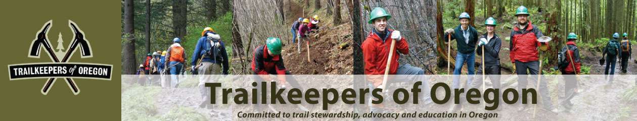 TrailKeepersOfOregon.org
OREGON TRAILS SUMMIT REGISTRATION IS OPEN!
October 27, 2017 Bend, Oregon
Summit will include:
• Opportunities to build relationships with trail advocates, land managers, trails professionals, dedicated volunteers, and fellow trails enthusiasts
• Keynote address and sessions on increasing access, addressing overuse, overcoming conflicts, and collaboration models
• Updates from Oregon Parks and Recreation Department, Travel Oregon, and the Oregon trails community
• Strategic planning for a nascent statewide trails coalition
• Off-site networking happy hour hosted by Travel Oregon
• FUN!
Who should come to the Oregon Trails Summit?
• Land management, parks and recreation, and transportation public agency professionals charged with developing and/or maintaining trails
• Professional trail builders and trail planners
• Volunteer and non-profit trail advocates, stewards, and crew leaders
• Trail outfitters, tour guides, and outdoor recreation industry professionals with an interest in trails
• Local leaders and policy makers who know trails are valuable to their communities
• Trails enthusiasts of all types
• YOU!
The Oregon Statewide Trails Coalition is being planned by a committee of public agency, non-profit, and private sector trails enthusiasts.
Sponsorship opportunities are available! Contact Steph at noll.stephanie@gmail.com for more info.
Register here:
https://www.trailkeepersoforegon.org/get-involved/oregontrailssummit/
Monday, September 4, 2017
Wisconsin: Northern Kettle Moraine Horse Trail Association completes trail project
Sheboyganpress.com - Full Article
For USA TODAY NETWORK - Wisconsin Published 9:43 a.m. CT Sept. 2, 2017
Northern Kettle Moraine Horse Trail Association completed trail enhancements totaling $32,000 on chronically wet Kettle Moraine State Forest - North equine trail. The Horse Trail Association values Wisconsin’s state forests and works hard to protect our right to enjoy these lands by horseback, according to a press release.
The association completed trail enhancements on the multi-use hiking, snowmobile and horseback riding trail in the Kettle Moraine State Forest – North Unit. Improvements included removing saturated soil with heavy equipment, installing geotextile fabric and material brought in to repair and solidifying the trail surface...
Read more here:
http://www.sheboyganpress.com/story/news/2017/09/02/community-notes-sheboygan-county-northern-kettle-moraine-horse-trail-association-completes-trail-pro/621865001/
Friday, September 1, 2017
Proposed LWCF Appropriations in 2018 Bill (8/29/2017)
PNTS.org
August 30 2017
The House Appropriations Committee is recommending appropriating $275 million from the Land and Water Conservation Fund (LWCF) to be used for acquiring land for conservation and recreation for Fiscal Year 2018. This is $125 million less than Congress appropriated for Fiscal Year 2017. During the Committee’s markup of the 2018 Bill, Appropriations Committee Chairman Rodney Frelinghuysen and Interior Subcommittee Chairman Ken Calvert both stated that they are willing to seek greater funding for LWCF in deliberations with the Senate later in the appropriations process. The House and Senate are expected to work toward passing the 2018 Appropriations bills in September after Labor Day.
Included in the recommended $275 million for the LWCF is funding for land acquisitions along or adjacent to these National Trails:
Bureau of Land Management
• Mojave Trails National Monument CA – Old Spanish NHT: $1.4M
• North Platte River Special Recreation Management Area WY – Oregon NHT: $1.3M
US Fish & Wildlife Service
• Cherry Valley National Wildlife Refuge PA – Appalachian NST: $500,000
National Park Service
• Appalachian NST – NY: $2M
• North Country NST – MI: $3.472M
US Forest Service
• Trinity Divide CA – Pacific Crest NST: $5M
Total: $13,672,000
If Congress appropriates $400 million for LWCF projects as it did for Fiscal Year 2017 then projects along the Continental Divide NST and Overmountain Victory NHT could be funded.
Thursday, August 31, 2017
Back Country Horsemen of America Keeps Trails Open for All in Arkansas
August 30 2017
by Sarah Wynne Jackson
Even today, over 40 years after its creation, Back Country Horsemen of America still adheres to the principles that guided its founders: keeping trails open for equestrians requires 1) a desire to keep trails open for all and 2) making yourself part of the solution with boots-on-the-ground trail work and generous distribution of responsible recreation skills through clinics and one-on-one instruction. The Buffalo River Chapter in Arkansas applies BCHA’s vision and mission to the wild lands in their state with determination, drive, and heart.
The Lands They Love
The Buffalo River Chapter BCH’s primary focus is the Buffalo National River and its watershed in northwest Arkansas. This National Park Service gem stretches 136 miles from Route 21, through five counties, to Route 14 and a Wilderness area also maintained by the NPS. Within and adjacent to the National River are Wilderness areas managed by the NPS and the US Forest Service, Ozark National Forest land, Wildlife Management Areas, and other conservation land.
Buffalo River Back Country Horsemen cherish this, America’s first National River. It flows freely nearly 150 miles from headwaters high in the Boston Mountains of Ozark National Forest to White River near Buffalo City. This national treasure encompasses almost 96,000 acres of rugged mountain terrain that is best accessed by horseback, massive limestone bluffs, deep hollows, and lush valleys.
Trails That Feel Like Home
BRBCH knows the 75 miles of equestrian trails very well. They ensure that they are clearly marked with yellow blazes, whether they are old road traces, gravel bars, or rocky mountain paths. These Back Country Horsemen remove downed trees, clear windfall, and repair water crossings on the trails that meander gently, crisscrossing the river many times. On the narrow, steep, and challenging trails, they repair washouts, dig out rocks in the trail tread, and lay down durable surfaces where needed.
Buffalo River Back Country Horsemen also maintain horse campsites, like the primitive camps at Steel Creek and Erbie, where recreationists find basic facilities like a pit toilet, fire grates, and places to hightie their horses. On the middle Buffalo, equestrians can stay at Woolum horse camp, which also has ample trailer parking. Wagon Gap and Hathaway camps on the lower Buffalo have no water and no facilities, but they access beautiful trails along the river.
Back Country Horsemen of the Buffalo River Chapter have spent many happy hours on horseback, both clearing and enjoying trails not only in the Buffalo National River, but also through the rest of their state’s stunning and varied landscapes. They help maintain trails in Wildlife Management Areas overseen by the Arkansas Game and Fish Commission, including the Gene Rush and the McElroy Madison County Wildlife Areas.
Keeping Trails Open for All
The Buffalo River Chapter works and coordinates with the Buffalo River National Park through a special Memorandum of Understanding that outlines their working relationship with the Park. Through regularly scheduled work days, the chapter puts their mission into action. They keep trails open to everyone by clearing brush and deadfall, pruning low-hanging branches, picking up trash, placing water bars to control erosion, and maintaining horse camps.
Their skills are especially valued when work is required in Wilderness areas too fragile for mechanized travel and power equipment. Their steady horses and mules haul equipment and supplies necessary for repairs, and the hard-working BRBCH members use hand saws, nippers, and loppers instead of chainsaws.
In 2015 alone, BRBCH contributed over 3072 volunteer hours to the Buffalo National River and its surrounding areas. Members also volunteered their time in the Ouachita Mountains, the Ozark National Forest, six different Wilderness Areas, and several Wildlife Management Areas maintained by Arkansas Game and Fish, totaling more than 1845 hours of trail work that year.
Promoting Responsible Recreation
In keeping with their mission to educate others on the wise use of our limited back country resource, Buffalo River Back Country Horsemen provide classes in CPR and first aid, packing with stock, and Leave No Trace Outdoor Ethics principles. They also host an annual Youth Camp Weekend that promotes responsible riding, packing, and camping skills to young people in a fun, safe environment.
Chapter members experienced with Leave No Trace, back country packing, and other skills regularly share their knowledge with other members and the general public. Several members are trained and participate in Wilderness Search and Rescue, providing a life-saving resource to the public.
The Original Horsepower
One spring, the National Park Service had cut some logs to be used to repair a badly washed out stretch of trail leading to the Hathaway Horse Camp in the Lower Buffalo River Wilderness. Five members of the Buffalo River BCH and their horses joined three NPS trail personnel in moving the logs to the repair location.
This area of the Ozark Mountains is a rough and rugged place to ride, but the washed-out trail was so hazardous that even experienced BCHers led instead of rode their sure-footed horses up the hill. They used horses and mules to drag thirty-five 8-foot cedar logs a quarter mile from the adjacent wooded area to the damaged trail so the repair could be made, all without the harm caused by motorized vehicles and equipment.
Well-Earned Accolades
The folks at the National Park Service are so grateful for the sustained volunteerism of Buffalo River Back Country Horsemen that they recently sent the chapter a letter that said in part, “...a BIG THANK YOU for all the volunteer hours donated to maintain horse trails at Buffalo National River. During this latest effort… your assistance put us about two weeks ahead of schedule... We are so thankful for all the park volunteers who help to make Buffalo National River such a great park!”
About Back Country Horsemen of America
BCHA is a non-profit corporation made up of state organizations, affiliates, and at-large members. Their efforts have brought about positive changes regarding the use of horses and stock in wilderness and public lands.
If you want to know more about Back Country Horsemen of America or become a member, visit their website: www.bcha.org; call 888-893-5161; or write 342 North Main Street, West Hartford, CT 06117. The future of horse use on public lands is in our hands!
Wednesday, August 30, 2017
Nurturing Land Management Relationships
ELCR.org - Full Article
July 12, 2016, by ELCR
Maintaining and Acquiring Horseback Access to Public Land, Trails and Facilities
By Denise Y. O’Meara, RLA | May, 2015
In the upstate areas of the New York City watershed, equestrians are losing access to trails on land newly acquired by the water authority. Often, the trail segments lost to use provide connections that can’t be replicated by detours as they cross long stretches of land. The New York State Horse Council is taking steps to understand why these trails have been closed to horses, and what they can do to regain access.
Publicly owned open space, lengthy trail corridors and a variety of landscapes create the backbone of our riding and driving needs. Managing public agencies range from municipal parks and woodlands, to state parks and natural resource areas, to federal parks and the vast natural resource zones. Ownership and management of these lands may also be jointly undertaken between multiple agencies.
A What to Do Guide
Get to Know Public Land Policies through the Agency Land Manager
If you are riding on public land, you should know not only the government agency or agencies involved, but their rules and regulations, their planning and decision-making processes and schedules, and the specific land managers for your region.
Keeping up with changes in access and other policies is a continual task, but one that must not be overlooked. When government agencies create policies that are unfriendly to horses, it is critical to gain an understanding of why these changes came about. To do that, horsemen and women need to develop lines of communication with public land managers...
Read more here:
https://elcr.org/nurturing-land-management-relationships/
Tuesday, August 29, 2017
National Recreation Trail: Forever Wild Wehle Trail System - Alabama
 Americantrails.org - Full Article
The Forever Wild Wehle Tract consists of 1,500 acres of rolling hill country through open pine grasslands and mature hardwood bottomlands.
The Forever Wild Wehle Tract consists of 1,500 acres of rolling hill country in Bullock and Barbour County, AL. The tract was once owned by Mr. Robert Wehle whose dream was to see that the property be protected by the Alabama Forever Wild Program and that the land be used for educating people about Alabama's need for conservation.
The Wehles generously funded the construction of the ROBERT G. WEHLE NATURE CENTER on land they deeded to the State Lands Division. This center was opened to the public for use for education and enjoyment.
There are three trails, which are part of the Forever Wild Wehle Trail System, that extend away from the Center, taking hikers on short, medium, and long treks through different habitats. These trails are augmented with interpretive stations highlighting the unique characteristics of many local plants and animals. The Nature Center can also be reserved for meetings, school field trips, and approved special events by appointment through the State Lands Division.
After opening the property to the public, roughly one third of it was added to the Barbour County Wildlife Management Area to increase acreage available for public hunting. The other two-thirds of the property are used for natural science education and non-consumptive recreational activities such as nature study, photography, hiking, picnicking, fishing, horseback riding and general field related activities...
Read more here:
http://www.americantrails.org/nationalrecreationtrails/trailNRT/Wehle-Trail-System-AL.html
Sunday, August 27, 2017
Washington: Hold Your Horses: Trail Riding Around the South Sound
SouthSoundTalk.com - Full Article
By Mariah Beckman
Hikes are better with friends, and some trailblazers say man’s best friend is the perfect companion, especially if your four-legged companion happens to be of the equine variety. If you fall into this category or have been looking for a good place to start a trail riding tradition, there are plenty of places near and far that can have you saddled up and ready to ride in no time.
Horse Ranches and Guided Tours
Sunset Chevrolet LogoEZ Times Trail Rides in Elbe, Washington, has been serving the South Sound for nearly 30 years. Owner Jeff Celskki cleared and shaped all of the trails around his Elbe ranch when he moved to the area in 1989, and the routes he created take riders past points of interest like Lake Adler, the Nisqually River and several overlooks that offer views of the Elbe Hills. Rates vary per trail and number of riders, but rest assured that horses here hit the trail rain or shine, sleet or snow. You can learn more about taking in a one-, two- or three-hour guided ride, designed for equestrians of all ages and experience levels, on EZ Times Trail Ride’s website. Kiddos are welcome!
Riding Horses in South Sound
Access miles of trails in the Puyallup River Valley when you visit Orting’s Northwest Horse Park. Riders here can enjoy wide open spaces, but also feel safe in the knowledge that seasoned equestrians are on site if any questions or concerns arise on the ride. And, because lessons are available at the park as well, this is a great place to identify areas where horse and rider can both improve before they ever step out on the trail and into wilder terrains...
Read more here:
http://www.southsoundtalk.com/2017/08/26/hold-your-horses-trail-riding-around-the-south-sound/
Wisconsin: Southern Kettle Moraine Horse Trails Association plans annual fall roundup
LakeCountryNow.com - Full Article
Lake Country Published 2:22 p.m. CT Aug. 16, 2017
Southern Kettle Moraine Horse Trails Association (SKMHTA) is once again preparing for its annual fall roundup, scheduled this year for Saturday, Sept. 9.
The event needs volunteers, donations for raffle baskets and silent auction items, as well as sponsors and cash donations to make this eighth annual fundraising event successful.
Proceeds are used to maintain and improve the horse trails and campground in the Southern Kettle Moraine Forest.
Past improvements include the electrification of 29 campsites and pavilion at Horseriders’ Campground, kiosk installation, purchase and maintenance of the Viele Loop portable toilet, donation to the Palmyra Corral Project, and installation and maintenance of the Obstacle Course Trail at the Highway S trails in Eagle and development of the Wilton Road rest area...
Read more here:
http://www.lakecountrynow.com/story/news/local/living-sunday/2017/08/16/southern-kettle-moraine-horse-trails-association-plans-annual-fall-roundup/567818001/
Tuesday, August 22, 2017
New Mexico: Horse owners, mountain bikers square off at meeting
LAMonitor.com - Full Article
By Tris DeRoma
Monday, August 21, 2017
A public discussion about a network of trails around the North Mesa Stables took a sharp turn Wednesday when county officials gave an update on a proposed “flow” trail meant exclusively for mountain bikers.
After County Parks and Recreation officials gave a brief update about the proposed flow trail, residents who attended the meeting debated whether the trail was a good idea at all.
According to county officials, the trail, if built, would parallel and intersect an existing popular horseback riding and hiking trail in Bayo Canyon.
“I think it’s a really bad idea to put it here,“ said resident Bruce Warren. “I think the county needs to reopen negotiation about installing a trial flow trail on the ski hill, which is where it really belongs, it’s a recreational type facility. It’s not really a trail in the sense of what we know is a trail.”
A proponent and founder of the flow trail idea said it couldn’t go on Pajarito Mountain because the ski area is privately owned.
Lisa Reader, an avid horseback rider and leader in the local riding community, thought the flow trail needs to be somewhere else too, that horse owners are slowly getting squeezed out of the recreational trail picture.
“I support multiple use as a concept. Our community is very small geographically, we only have a small footprint to work in, we don’t need to be fussing and fighting with each other. But, I will say that we are out here for good, and we keep getting squeezed and squeezed,” Reader said. “There’s so few places we can safely access anymore, so this (plan) is an eyeopener to us. This is the one trail we have easy access to and now they’re going to make it potentially unsafe...”
Read more here:
http://www.lamonitor.com/content/horse-owners-mountain-bikers-square-meeting
Monday, August 7, 2017
Congress Continues to Promote Land Access, Gives Momentum to “Trails Act” Victory
Horsecouncil.org
August 3 2017
On July 26, Sen. Ron Wyden (D-OR) and Rep. Rob Bishop (R-UT) introduced the “Recreation Not Red-Tape Act (RNR)” (S. 1633, H.R. 3400), legislation that expands the scope of the National Forest System Trails Stewardship Act (PL 114-245), signed into law in late 2016. While the RNR focuses on streamlined permitting to access public lands, the bill includes provisions that would authorize the Department of the Interior, through the Bureau of Land Management (BLM), to enter into cooperative agreements with private parties to promote the role of volunteers in trail maintenance. The bill also authorizes the Department of Agriculture (USDA) and BLM to develop an interagency trail management plan that will assure uniform maintenance standards for trails crossing jurisdictional lines between the two agencies.
The Trails Act outlines a detailed program including goals and timetables by which the USDA will leverage private partners to clear trails long overdue for maintenance. Unlike the RNR Act, which applies to both the BLM and USDA’s National Forest System (NFS), the Trails Act focuses only on trails under the jurisdiction of the NFS.
Chairman Bishop and Sen. Wyden worked closely on the bill to emphasize key issues – especially outdoor recreation permit streamlining – that will likely attract bipartisan support. GOP staff with the House Natural Resources Committee, which is the committee of jurisdiction for federal land issues, are encouraging AHC and allies to help drive cosponsors for the legislation, which currently has none. Committee staff also state that the Subcommittee on Federal Lands will conduct a markup in late September or October, giving members the opportunity to offer technical corrections and amendments to the text.
To review a summary of the legislation, please see the following link: https://www.wyden.senate.gov/download/?id=DDF411A6-5D21-40BD-B17C-2BF73A2B9C51&download=1. If you would like more information about the RNR Act and related lobbying activity, please contact Bryan Brendle at bbrendle@horsecouncil.org or 202-296-4031.
Saturday, August 5, 2017
ELCR and USDF Partner for Equine Land Conservation Achievement Award
July 6 2017
ELCR, in partnership with the United States Dressage Federation (USDF), is pleased to announce the inaugural Equine Land Conservation Achievement Award. Nominations for the award, which recognizes an individual or organization for outstanding achievement in protecting land or access to land for equine use. USDF's Regional Group Membership Organizations (GMO) will nominate those individuals, organizations or agencies that they feel have exhibited exceptional land or facilities advocacy or protection related to the dressage community with local or nationwide impact.
USDF executive Director, Stephan Hienzsch, says that the organization is 'very pleased to partner with ELCR on this award to help increase awareness of the importance of land conservation in the dressage community and to serve as inspiration to others within our discipline."
The award will be presented at the Adequan/USDF Annual Convention awards ceremony on Saturday, December 2, 2017 in Lexington, KY. Convention and awards ceremony information may be found here .
Wednesday, August 2, 2017
Back Country Horsemen of America Trail Work Helps Contain Forest Fire
August 1 2017
by Sarah Wynne Jackson
Back Country Horsemen of America takes very seriously their mission to ensure that public lands remain open to recreational stock use, and they know that their hard work also allows other user groups to enjoy more recreation opportunities. But sometimes BCHA’s on-the-ground trail work makes a difference in other, unexpected ways.
Reclaiming Neglected Trails
From July 28 through 31, 2015, eight members of the San Joaquin-Sierra Back Country Horsemen of California joined four US Forest Service workers clearing a two mile long trail that connects the Rancheria Trail to Spanish Lake in the John Muir Wilderness of the Sierra National Forest. The trail was so overgrown and neglected that they sometimes had difficulty finding the original path. After several long days of hard labor, the team had removed 64 downed trees and cleared over 1000 feet of trail, making it passable once again for all trail users, including equestrians.
Mission Accomplished, Just in Time
On July 31, the day they finished their work and packed out to head home, lightning struck about five miles north of Hume Lake, not far from where they had been working. It started the largest wildfire California saw that year. The Rough Fire burned unchecked until it destroyed 151,623 acres and was finally contained on November 5.
The Original Horsepower Protects Wilderness Areas
When wildfires burn in wilderness areas, firefighters try to honor the rules in place to protect those lands by using Minimum Impact Suppression Tactics (MIST). This includes using pack stock instead of mechanized transport to deliver supplies to firefighting crews. The USFS called on their packers to relay supplies to four different groups that were fighting the fire.
Because the trail to Spanish Lake was clear, it was used as a fire line for the back burn. Firefighters set backfires to burn up the available fuel and stop the progression of the wildfire, which was heading toward drought-stricken timbered areas that would have allowed the fire to gain strength and speed. The accessible trail gave firefighters an open area to set backfires as well as providing an easy route for pack horses and mules to deliver supplies to various teams along the fire line.
Once the back burn started moving away from the trail and towards the main fire, the recently opened corridor was invaluable in allowing firefighters to make daily patrols to ensure no burning material came down across the trail which could have started a new fire on the other side of the fire line. The crews remained vigilant until they knew the flames were fully suppressed.
Fighting the Fire Breathing Dragon
The Rough Fire burned almost twice as many acres as the second largest wildfire in California that year, and required 3,742 firefighters with 345 engines, 19 helicopters, and 45 bulldozers to contain. It threatened life and property, necessitating evacuation of Hume Lake Christian Camps, Dunlap, and the Wilsonia and General Grant Grove areas. The fire approached (but didn’t reach) the heavily populated areas of Fresno and Clovis. It resulted in ten injuries, one of them a firefighter who suffered severe burns and was airlifted to a medical facility, and hospital emergency rooms filled with folks with respiratory distress due to smoke inhalation.
The fire line along the newly re-opened trail proved to be a major factor in containing this massive wildfire. The Back Country Horsemen of the San Joaquin-Sierra Chapter were just doing what they do: keeping trails open for all users to enjoy. They didn’t know that accomplishing this humble task would make it possible to keep a fire-breathing dragon from becoming an even bigger monster and swallowing up more of the state’s stunning landscape and maybe even claiming human lives and homes.
About Back Country Horsemen of America
BCHA is a non-profit corporation made up of state organizations, affiliates, and at-large members. Their efforts have brought about positive changes regarding the use of horses and stock in wilderness and public lands.
If you want to know more about Back Country Horsemen of America or become a member, visit their website: www.bcha.org; call 888-893-5161; or write 342 North Main Street, West Hartford, CT 06117. The future of horse use on public lands is in our hands!
Thursday, July 27, 2017
A California counter-attack could ward off land transfers
HCN.org - Full Article
In response to Trump, the West’s most liberal state goes on the offensive.
Tay Wiles
News
July 26, 2017
The morning after the 2016 presidential election, California’s legislative leaders issued a message that has set the tone for the state under the new administration, under President Donald Trump. “Today, we woke up feeling like strangers in a foreign land,” it said. Since then, many Californians have pushed back against conservative policies on everything from immigrant rights to the environment. One of those offensives is Senate Bill 50, which, after sailing through committee this spring and summer, aims to stop the federal government from transferring or selling off public lands to corporations.
The Public Lands Protection Act is part of a series of three bills introduced in late February called the “Preserve California” package, meant to preempt any efforts by the Trump administration to weaken environmental laws. The bill would allow California’s State Lands Commission first dibs on lands the federal government wants to sell, and would let the state have a say in transferring to a new owner.
The law is largely symbolic. The intense push led by conservative lawmakers in Western states beginning around 2012 for a massive transfer of federal lands to state and local control has slowed. That’s in part thanks to the Trump administration, which offers other means for conservatives to influence land management from within agencies. Interior Secretary Ryan Zinke says he does not support the land transfer idea, but he is sympathetic to critics of federal overreach in natural resource management...
Read more here:
http://www.hcn.org/articles/california-bill-aims-to-protect-public-lands
Friday, July 21, 2017
New York: Equestrian paths offer miles of scenic beauty
ObserverToday.com - Full Article
JUL 19, 2017
DAMIAN SEBOUHIAN OBSERVER STAFF WRITER
JAMESTOWN — The final phase in upgrading the Chautauqua County Equestrian Trail system is all a matter of time and partially dependent on future funds, said Senior Planner Patrick Gooch of the Chautauqua County Planning Department.
“There’s a four-phase plan to extend the trails,” said Gooch. “Phases one through three are completed.”
According to Missy Whittington, long time volunteer and newly appointed president of the trail system, “we’ve just completed the incorporation of Chautauqua County Equestrian Trails (CCET) as its own entity. We have filed paperwork to become a 501c3, so we’re a not-for-profit organization for the trail.”
Currently, the trail runs along existing pathways and new connections that extend from the northwestern corner of Boutwell Hill State Forest to the peaks of the Cockaigne Ski Area in the south and over to the village of Cherry Creek, with many privately developed trails in between, which are accessible to the public...
Read more here:
http://www.observertoday.com/news/local-region/2017/07/equestrian-paths-offer-miles-of-scenic-beauty/
Wednesday, July 19, 2017
Nominations for the Ann Parr Trails Award due August 1
Ann Parr Trails Preservation Award Recipients
This award, named after trails volunteer Ann Parr, was first given in 2012, and honors the member who has worked tirelessly for equine trails.
Ann supported the Trails and Land Management Committee with her time, effort and knowledge. She worked with state count and city political offices from her home in Draper, Utah, to promote trail easement preservation and urban trails development. Ann led a campaign to enable the city of Draper to purchase an area previously slated for residential development for use as a public outdoor recreation area. Her trail advocacy and committee work are an inspiration for those who care for and work to preserve and expand equestrian trails across the country.
Sharon Ballard proposed this award on the death of her beloved friend in 2011.
This award may not be given every year.
Nominations are due August 1. Nomination form is available here:
https://aerc.org/static/2017Nomination.aspx
Wednesday, July 12, 2017
Call to Protect Your Trails Funding
Hello Trail Partners,
As you heard in our last call to action, the Administration's proposed budget for fiscal year 2018 reveals what are nothing less than catastrophic cuts to programs that directly impact trails and the places where Americans ride, bike, hike, and enjoy the outdoors. The proposed budget for trails and the federal agencies that manage and maintain trails on federal lands fails to provide for even the most basic necessities needed to maintain and manage these critical recreation resources.
The President's budget cuts the Land and Water Conservation Fund (LWCF) by 84% compared to the amount approved by Congress for 2017. Similarly, the President's budget would cut the trails program of the U.S. Forest Service by 84%. There is little doubt the agency would be forced to make sweeping personnel changes that would leave few staff among local ranger districts to work with volunteers and partners-to say nothing about the complete lack of seasonal trail crews that could be expected next year. Such budget cuts would be disastrous and unprecedented.
The good news is that Congress does not have to follow the President's proposed budget for 2018. But members of Congress need to hear from you. Otherwise, they just might fall in line behind the President's budget proposal.
Take Action!
Please call your member of Congress today.
1. Let them know that trails and outdoor recreation are important to you.
2. Ask them to maintain the Land and Water Conservation Fund in 2018, at the minimum, at a level consistent with what Congress approved in 2017.
3. Ask that they support levels of funding that keep agency trail programs intact, as volunteers alone cannot be expected to do it all.
4. Ask that funding for trails reflect the growing importance of trails to the American public, including the outdoor "recreation economy," which directly supports 7.6 million jobs across the U.S.
To find information, including a phone number, for your representative in Congress click on this link. For contact information for your U.S. senators, click here. And if your congressman or senator is on one of the committees that control the agency budgets (i.e. the Senate or House Appropriations Committees, or the Interior Subcommittees) then your immediate action is especially helpful! Please consider reaching out to them immediately to let them know that you care about trails and trails infrastructure.
If you desire more background and information on this issue, 3-page paper and a sign-on letter was carefully crafted in partnership with the American Hiking Society, Backcountry Horsemen of America, and the Partnership for the National Trails System, reflecting the level of concern among all trail user groups.
Please take action TODAY to preserve access to trails on public lands.
Our future access to public lands depends on it. Thank you for your efforts to ensure trails for everyone's future.
Michael Passo
Executive Director, American Trails
Tuesday, July 11, 2017
ELCR Launches National Survey
On June 21st, Equestrian Land Conservation Resource launched our nationwide survey of locally-based organizations that are working on equine advocacy and land related issues. This ground breaking comprehensive survey will reveal important information about survey respondents, including their mission, existing partnerships, historical activities, model organizations, best practices, successes and failures as well as common issues and challenges shared among respondents.
ELCR needs to continually renew our perspective on the equine community's land protection needs. Through the survey, respondents will be talking about their equine advocacy activities, giving us greater insight into where we should focus or re-direct our assistance and advocacy efforts.
The survey is in partnership with the University of Kentucky's Community and Economic Development Initiative of Kentucky (CEDIK) as part of ELCR's ambitious three-year strategic plan (which can be viewed in full here). ELCR will utilize the results of the survey to inform and fine-tune our educational programming, resources and technical assistance services in order to better support local advocacy and conservation efforts.
ELCR Executive Director, Holley Groshek, says "We know there are many outstanding local efforts across the country as organizations deal with equine advocacy and land protection issues. Success stories and best practices will be shared within our national network. ELCR will develop a better understanding of how we can best use our resources to support local equine advocacy and land conservation efforts."
If your organization would like to participate in the survey, please contact Abby Gates at agates@elcr.org.
Thursday, July 6, 2017
Drastic Cuts Proposed for National Scenic and Historic Trail Funding
PNTS.org
6/30/2017
The National Scenic and Historic Trails administered and managed by the U.S Forest Service are funded from the agency’s Trails Account (CMTL). For FY 2017 Congress appropriated $77.383 million for that account. The proposed Trump Budget for FY 2018 provides just $12.7 million for the Forest Service to maintain over 155,000 miles of trails—a reduction of 84%! If the Forest Service allocates a proportionate amount of funds for the National Trails at this funding level only $1.268 million will be available for them.
Read our testimony here.
Sustaining Equestrian Trails
June 30, 2017, by ELCR
By Denise Y. O’Meara for Equine Land Conservation Resource
Here’s a wellness aspect you may not have considered – the condition of your horse trails. A poorly designed or maintained trail can lead to that most dread situation, denial of equine access.
To remain available to horseback riders, trails need respectful treatment. From design to maintenance, from concept to long term preservation, careful thought and actions are paramount for equestrians to sustain trail access.
The relationships that you have with landowners and managers need to be nurtured and maintained too. Lack of respect for these relationships will likely lead to angry people and closed trails.
THINGS TO THINK ABOUT
1. Whether public or private, trail landowners and managers have a stake in the value and condition of their land. Trail abuse by equestrians makes them very unhappy.
2. Land owners and managers are always concerned about liability. A lack of understanding about liability protections can prevent a trail from ever being built or close one to use. See: ELCR Article, How to Assure the Reluctant Landowner
Photo courtesy Mike Riter
3. Horses are tough on land. The torque of pointy feet leads to churning of soil and plants, creating conditions for erosion.
4. Stormwater runoff makes trail erosion possible. Once erosion starts it needs to be corrected quickly. Clay soils are especially prone to erosion.
5. Rider behavior on the trail can result in enjoyable outings. Or it can undermine trail owner/manager relations. Contributing to erosion by riding off the trail, riding in wet weather conditions, leaving trash behind, not watching out for other users and not reporting trail damage are examples of bad rider behavior. See: ELCR Article, Rules of the Ride – Model Rules for Trail Riders
6. Community planners make decisions about land use in your trail areas. In fact, they probably already have. Research current and future decisions that may affect your trails access. Without this knowledge, you may miss the chance to prevent trail closings and to help guide recreational and equine accessible trail planning to your community. See: Three Words Every Equestrian Should Know: Land Use Planning
7. The combination of bad rider behavior, poor landowner/manager relations, degraded trail conditions and uninformed equestrians, you will eventually lose access. Trail Gone. No New Trails. This Means You...
Read more here:
https://elcr.org/sustaining-equestrian-trails/
Wednesday, July 5, 2017
Anza Area Trail Town committee becomes a nonprofit corporation
AnzaValleyOutlook.com - Full Article
By Newsroom on July 3, 2017
ANZA – Following an Anza Valley Municipal Advisory Council Meeting in August 2014, a group of residents from Anza and Aguanga joined together to form a committee with the purpose of finding ways to establish community trails in the Anza and Aguanga Area.
This group of like-minded people is working with the long-term vision of finding a way to design, create, construct and promote a more comprehensive and sustainable trail system that will enhance our area for residents and visitors alike. The all-volunteer committee has met six times a year since its formation in 2014 and has worked diligently. The work has not been easy and the committee has become well educated on the many nuances and obstacles for its vision to become feasible To date the committee has begun to map trails in the local area, attended meetings with Riverside County staff and other government officials on solutions to make community trails a reality, and the committee has attended meetings with local stakeholders and community members.
The volunteers determined their course of action for the community to take and make the vision a reality was to become a 501(c)(3) nonprofit corporation. So as of March 2017, the Anza Area Trail Town (AATT) incorporated and begins its job of making a comprehensive community trail system a reality in our area.
. If you walk, ride a horse or mountain bike on many of the local dirt roads you see magnificent views of Cahuilla, Thomas, and Beauty Mountains which embrace the Anza Valley. The newly incorporated nonprofit wants these views to be seen from common trails that will enhance the community’s leisure and pleasure...
Read more here:
http://anzavalleyoutlook.com/local/anza-area-trail-town-committee-becomes-nonprofit-corporation/
Saturday, July 1, 2017
Great Shasta Rail Trail: a link to history in northern California
 AmericanTrails.org
From Great Shasta Rail Trail Association
The Great Shasta Rail Trail follows the route of the eastern expansion of the McCloud River Railroad, stretching across 80 miles of the natural and human history of the west. The town of McCloud, at the western end of the trail, sits on the southern flank of Mount Shasta, an isolated volcanic peak rising 14,162 feet above sea level. Along the route, there are dense stands of timber, which drew loggers and early settlers.
As the logging industry drew the railway east and south, camps, villages, and towns sprang up along the route until the railroad reached the vast timber resources surrounding Burney, the southern terminus. Though the railroad is gone, the towns remain. The story of the railroad still connects these communities, and will come alive again through the Great Shasta Rail Trail.
In 2005, McCloud Railway Company (MCR) petitioned the Surface Transportation Board (STB) to abandon their 80-mile rail line between Burney and McCloud, California. In March, 2009, individuals interested in converting the entire 80-mile rail line (over 1,000 acres) into a trail formed a trail coalition. There was broad based community support for development of the proposed trail from local businesses and organizations, State and Federal agencies, land trusts, and individuals.
A Core Team of non-profit organizations was composed of the Shasta Land Trust, Volcanic Legacy Community Partnership, McCloud Local First Network, and Ventura Hillsides Conservancy. The Core Team completed a draft “Trail Feasibility Study,” which describes the social and economic values of converting the corridor to public trail purposes. The Great Shasta Rail Trail Association (GSRTA) will lead detailed planning efforts, trail development, maintenance work, interpretative, and stewardship efforts.
On November 23, 2009, SBF petitioned the STB for issuance of a “Notice of Interim Trail Use” (NITU). On December 3, 2009, MCR agreed to negotiate a “rail banking” Purchase Agreement for their 80-miles of rail line. On December 28, 2009, STB accepted and granted SBF’s request of NITU.
The completed recreational trail will provide numerous benefits to the rural communities of Burney and McCloud, as well as to adjacent property owners. Many studies have shown that recreational trails stimulate tourism and recreation-related spending, increase property values, and attract new businesses, which all benefit local economies.
Greater opportunities for outdoor exercise and recreation will improve the quality of life and health benefits for Shasta and Siskiyou County residents and tourists. GSRT will provide an invaluable link between Burney, McCloud, and McArthur-Burney Falls Memorial State Park. It will also connect with the Pacific Crest National Scenic Trail and recreation facilities on adjacent national forest land. GSRT is envisioned as a shared-use trail, providing opportunities for hiking, biking, equestrian use, cross-country skiing, and possibly motorized trail uses such as winter snowmobiling.
In addition to increased opportunities for recreation and tourism, GSRT will also protect important natural resources and scenic amenities in northern California. The corridor offers almost innumerable possibilities for scenic overlooks and access to several streams, rivers, falls, and lakes for camping, picnicking, and fishing. It will provide access to hunting areas as well as opportunities for wildlife viewing and plant study. The trail will serve as a long-term fire break and critical access for emergency fire suppression. It will protect several historical sites and provide a new venue for community events to stimulate local economies through tourism and fund raisers.
In February 2013, a workshop brought together members of the San Francisco and Sacramento Chapters of the American Society of Landscape Architects, and Great Shasta Rail Trail volunteers to create design concepts for the trail. The workshop involved an overview of the proposed trail, outlining regional and cultural history, user needs, and goals for the project, with special focus on the locations of identified trailheads and the region’s natural resources and topography.
The trail will echo the route of the rail line and, although the rails have been removed, its sinuous journey through the Sierra–Cascade landscape remains. Most of the trail surface will be compacted volcanic cinder and at least eight feet wide, but near access points and communities, it is envisioned that the trail will be a hard surface to provide for accessibility. Where feasible within the corridor, an equestrian trail will parallel the pedestrian–bike trail, either on the trail shoulder or as a separate trail. Motorized use will be limited to areas where existing uses cross the trail corridor.
For more information and maps, see:
http://www.americantrails.org/resources/railtrails/Great-Shasta-Rail-Trail-CA.html
Wednesday, June 28, 2017
Administration Budget Decimates Trails Funding - You Can Help
June 26 2017
Sign on Your Organization to Protect Trails
Hello Trail Partners,
The Administration's proposed budget for fiscal year 2018 reveals what are nothing less than catastrophic cuts to programs that directly impact trails and the places where Americans hike and enjoy the outdoors. The proposed budget for trails and the federal agencies that manage and maintain trails on federal lands fails to provide for even the most basic necessities needed to maintain and manage these critical recreation resources.
We are stronger when we stand together.
A sign-on letter was carefully crafted in partnership with the American Hiking Society, Backcountry Horsemen of America, and the Partnership for the National Trails System, reflecting the level of concern among all trail user groups. If your organization is as shocked at the Administration's proposed budget as most of us who support trails, outdoor recreation, and public lands, we ask that you add your organization's name to the sign-on letter which will be provided to the appropriators and other members of Congress.
If you are a partner organization, please sign on to this letter. If not, please share this with your favorite organizations including those who are not trails-specific but that advocate for things such as public health, business, and outdoor recreation.
Sign on now:
https://americanhiking.org/advocacy/support-trails-funding-in-2018-federal-budget/
Subscribe to:
Posts (Atom)