 AmericanTrails.org
From Great Shasta Rail Trail Association
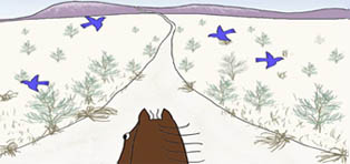
The Great Shasta Rail Trail follows the route of the eastern expansion of the McCloud River Railroad, stretching across 80 miles of the natural and human history of the west. The town of McCloud, at the western end of the trail, sits on the southern flank of Mount Shasta, an isolated volcanic peak rising 14,162 feet above sea level. Along the route, there are dense stands of timber, which drew loggers and early settlers.
As the logging industry drew the railway east and south, camps, villages, and towns sprang up along the route until the railroad reached the vast timber resources surrounding Burney, the southern terminus. Though the railroad is gone, the towns remain. The story of the railroad still connects these communities, and will come alive again through the Great Shasta Rail Trail.
In 2005, McCloud Railway Company (MCR) petitioned the Surface Transportation Board (STB) to abandon their 80-mile rail line between Burney and McCloud, California. In March, 2009, individuals interested in converting the entire 80-mile rail line (over 1,000 acres) into a trail formed a trail coalition. There was broad based community support for development of the proposed trail from local businesses and organizations, State and Federal agencies, land trusts, and individuals.
A Core Team of non-profit organizations was composed of the Shasta Land Trust, Volcanic Legacy Community Partnership, McCloud Local First Network, and Ventura Hillsides Conservancy. The Core Team completed a draft “Trail Feasibility Study,” which describes the social and economic values of converting the corridor to public trail purposes. The Great Shasta Rail Trail Association (GSRTA) will lead detailed planning efforts, trail development, maintenance work, interpretative, and stewardship efforts.
On November 23, 2009, SBF petitioned the STB for issuance of a “Notice of Interim Trail Use” (NITU). On December 3, 2009, MCR agreed to negotiate a “rail banking” Purchase Agreement for their 80-miles of rail line. On December 28, 2009, STB accepted and granted SBF’s request of NITU.
The completed recreational trail will provide numerous benefits to the rural communities of Burney and McCloud, as well as to adjacent property owners. Many studies have shown that recreational trails stimulate tourism and recreation-related spending, increase property values, and attract new businesses, which all benefit local economies.
Greater opportunities for outdoor exercise and recreation will improve the quality of life and health benefits for Shasta and Siskiyou County residents and tourists. GSRT will provide an invaluable link between Burney, McCloud, and McArthur-Burney Falls Memorial State Park. It will also connect with the Pacific Crest National Scenic Trail and recreation facilities on adjacent national forest land. GSRT is envisioned as a shared-use trail, providing opportunities for hiking, biking, equestrian use, cross-country skiing, and possibly motorized trail uses such as winter snowmobiling.
In addition to increased opportunities for recreation and tourism, GSRT will also protect important natural resources and scenic amenities in northern California. The corridor offers almost innumerable possibilities for scenic overlooks and access to several streams, rivers, falls, and lakes for camping, picnicking, and fishing. It will provide access to hunting areas as well as opportunities for wildlife viewing and plant study. The trail will serve as a long-term fire break and critical access for emergency fire suppression. It will protect several historical sites and provide a new venue for community events to stimulate local economies through tourism and fund raisers.
In February 2013, a workshop brought together members of the San Francisco and Sacramento Chapters of the American Society of Landscape Architects, and Great Shasta Rail Trail volunteers to create design concepts for the trail. The workshop involved an overview of the proposed trail, outlining regional and cultural history, user needs, and goals for the project, with special focus on the locations of identified trailheads and the region’s natural resources and topography.
The trail will echo the route of the rail line and, although the rails have been removed, its sinuous journey through the Sierra–Cascade landscape remains. Most of the trail surface will be compacted volcanic cinder and at least eight feet wide, but near access points and communities, it is envisioned that the trail will be a hard surface to provide for accessibility. Where feasible within the corridor, an equestrian trail will parallel the pedestrian–bike trail, either on the trail shoulder or as a separate trail. Motorized use will be limited to areas where existing uses cross the trail corridor.
For more information and maps, see:
http://www.americantrails.org/resources/railtrails/Great-Shasta-Rail-Trail-CA.html
No comments:
Post a Comment