Americantrails.org
The 67-mile designated National Recreation Trail spans the Santa Monica Mountains, an east-west trending mountain range that bifurcates Los Angeles and tumbles down to the Pacific Ocean.
By Melanie Beck National Park Service
With just two days to go before the Backbone Trail grand opening event, National Park Service staff at Santa Monica Mountains National Recreation Area were anxious. Finishing up the last acquisitions for the trail and getting the final section built in time for the June 4th celebration had kept park staff fighting against time all year.
What a delight it would be to be able to announce the National Recreation Trail designation! Then, Superintendent David Szymanski got the good word: An email popped up from Helen Scully, National Recreation Trails Coordinator at National Park Service, announcing: “Congrats on your new NRT! The Backbone Trail was signed off today.”
In that moment, a long-held vision to have the Backbone Trail as a National Recreation Trail became reality. Staff exhaled a sigh of relief and then whooped for joy. The 50-year effort could be summed up as “The simple act of walking on a trail is anything but simple to create.”
With some 180 parcels to acquire on the direct alignment, many more for viewshed, and miles of trail to build, nothing short of a harmonic convergence among citizens, park agencies, and legislators created what we have today.
The 67-mile trail spans the Santa Monica Mountains, an east-west trending transverse mountain range that bifurcates Los Angeles and tumbles down to the Pacific Ocean. You only have to go a short distance from the coast, though, before the Mediterranean-type climate can get hot...
Read more here:
http://www.americantrails.org/nationalrecreationtrails/trailNRT/Backbone-Trail-Santa-Monica-Mountains-NRT-CA.html
Saturday, April 29, 2017
Friday, April 28, 2017
A tussle in Oregon raises concerns about handing land to states
Economist.com - Full Article
What happens when trust forests no longer make money
Apr 12th 2017
SCOTTSBURG, OREGON
DEEP in Oregon’s Elliott State Forest, past groves of 200-foot Douglas firs and bigleaf maple trees dripping with emerald green Spanish moss, Joe Metzler pulls over his Toyota truck and peeks over a precipitous slope covered in tree stumps for signs of elk. Mr Metzler, a retired coastguard rescue swimmer who looks a good deal younger than his 49 years, frequently hunts in the area. To make a clean kill with his bow and arrow, he sometimes camps out in the forest for a week. Then comes the really tough part: hauling 300lb of meat to his car, which is sometimes parked miles away. “It is not old man’s hunting,” he says gleefully.
Soon Oregon may sell 82,500 acres, or most of what remains of the dense forest, to a timber company and a Native American tribe. The proposal would allow public access on half the land. But sportsmen, who can currently roam the forest mostly as they please, worry it will be hard to reach or unsuitable for hunting. Environmentalists fret protections for threatened species would be relaxed.
The Elliott State Forest is not directly owned by the state; it is state trust land, which is required by Oregon’s constitution to produce profit for public schools. The Elliott does that through logging. State trust lands are common in the American West. They trace their roots to 1803, when Ohio joined the union and was given a grant of land to support public education. The practice was replicated throughout the process of state accession, and today there are approximately 46m acres of such lands, 85% of which lie west of the Rocky Mountains.
Recently the Elliott State Forest has struggled to meet its financial responsibilities...
Read more here:
http://www.economist.com/news/united-states/21720662-what-happens-when-trust-forests-no-longer-make-money-tussle-oregon-raises-concerns
Friday, April 21, 2017
Virginia: Horse Riding in the George Washington National Forest
Equitrekking.com - Full Article
April 18, 2017
Riding Down the Rabbit Trail and Memory Lane in Shenandoah County!
by Susan St. Amand
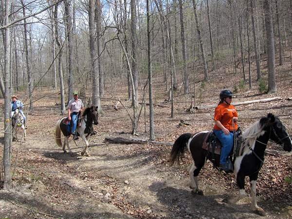
Recently, members of the Shenandoah Trail Riders and Horseman's Association enjoyed a beautiful spring day trail riding in Shenandoah County through a portion of the George Washington National Forest. Splashes of purple painted the forested landscape from Virginia's designated state tree, the Dogwood.
While this day happened to be Easter Sunday, it did not stop the “Easter Bunny” from taking a break and joining the ride down the rabbit trail with a bedecked purple cowgal hat!
The George Washington National Forest covers a large area along the Appalachian Mountains situated along the western part of Virginia and into West Virginia as well as connecting to the Jefferson National Forest on the southern end of the Shenandoah Valley. This mountain range is also found between the Allegheny Mountains to the west and the Blue Ridge Mountains to the east, running along the Interstate 81 corridor. Needless to say, the area has very many beautiful and scenic mountain vistas, and STRHA riders frequent the numerous trails that the GWNF has to offer...
Read more here:
http://www.equitrekking.com/articles/entry/horse-riding-in-the-george-washington-national-forest/?mc_cid=304da4a568&mc_eid=290b655fe3
Senate and House Outdoor Recreation Caucuses Announced
Outdoorindustry.org - Full Article
We are pleased to let you know that for the first time ever, the United States Congress now has a bicameral, bipartisan caucus dedicated to the outdoor recreation industry. In the past few weeks, the Senate Outdoor Recreation Caucus (SORC) was established by Co-Chairs Senator Jim Risch (R-ID) and Senator Martin Heinrich (D-NM), and for the first time, a House Outdoor Recreation Caucus (HORC) has been established by Co-Chairs Representative Mike Simpson (R-ID02) and Representative Jared Polis (D-CO02).
“The House and Senate Outdoor Recreation Caucuses will provide a critical forum to highlight the growing impact of the outdoor recreation economy and how outdoor enthusiasts of all stripes can come together to support healthy communities and healthy economies,” said OIA’s Executive Director Amy Roberts. “As we work to preserve our public lands and waters as the backbone of outdoor recreation businesses and support the growth and success of manufacturers, retailers and outfitters, I know we can count on the leadership and support of Representatives Simpson and Polis and Senators Risch and Heinrich.”
Both the House and Senate Outdoor Recreation Caucus are a forum for members to support the outdoor recreation sector and industry businesses of all types, while encouraging Americans to engage in, understand and reap the benefits of outdoor recreation...
Read more here:
https://outdoorindustry.org/article/senate-and-house-outdoor-recreation-caucuses-announced/
Tuesday, April 18, 2017
Free Trails 50th Anniversary Webinar
Date and Time: Wednesday, April 19th at 3PM EST
Title: Commemorating the 50th Anniversary of the National Trails System Act
Presenters: Gary Werner (PNTS), Pete Olsen (American Hiking Society), Chelsea Bodamer (PNTS)
Cost: Free
Webinar Overview: In his 1965 “Natural Beauty Message” to Congress, President Lyndon B. Johnson inspired a national “system of trails” for the American people. Congress passed the National Trails System Act, signed into law by President Johnson on October 2, 1968. Join us for our upcoming webinar and learn how you can take part in the commemoration of this historic act while encouraging a new generation of trail users and stewards. Capacity is limited to 100 attendees. Register early to ensure your spot.
Topics include:
• The importance of the 50th Anniversary
• Partners and opportunties
• How you can take part
• Available resources and toolkit items
For more information and to register see:
http://pnts.org/new/webinars/
National Forest System Trail Stewardship Grants Available for Field Season 2017
BCHA.org
As a result of Back Country Horsemen of America's recent collaborative efforts with national partners, The National Wilderness Stewardship Alliance announced this week the creation of a new trails granting program. “National Forest Trail Stewardship Grants” are supported by the U.S. Forest Service and are intended to address the trail maintenance backlog on National Forest System trails.
Current nonprofit organizations (e.g., 501 (c)(3), 501 (c)(7)) in good standing with the IRS may apply for these Grants. Organizations must have a sponsored volunteer or other agreement with their local Forest Service office for work performed under these grants.
Approximately $230,000 is available during this round of Trail Stewardship Grants for work to be performed from June through December 2017.
Details of the grant program including a Fact Sheet, Application Form, and Budget Form, are available at: www.wildernessalliance.org.
The Trail Stewardship Grant application period will run from April 14 to June 2, 2017. Applications should be emailed to: TrailGrants@wildernessalliance.org.
Questions about the Trail Stewardship Grant program should be addressed to the Grant Manager, Randy Welsh, Executive Director, National Wilderness Stewardship Alliance at 801-808-2167 or randy@wildernessalliance.org.
Good luck! We hope to see this grant program continue to grow, both in terms of its size (dollar amount available) and its availability year after year. It’s another good indication that our friends at the U.S. Forest Service are serious about making trails a high priority.
Sincerely,
Donald Saner, BCHA Chairman
Friday, April 14, 2017
Oregon: Equestrians, long-time stewards, vie for trails
BendBulletin.com - Full Article
Equestrians, long-time stewards of local trails, vie for their use
By Peter Madsen, The Bulletin, @OutdoorsyInBend
Published Apr 13, 2017
When Kim McCarrel recently saddled up Bella, her chestnut-colored Tennessee walker, and set out on a group ride at Maston Trailhead in the Cline Buttes Recreation Area, a mountain biker darted into the periphery. Ears pricked, Bella slowed her trot and trained her attention toward the juniper trees through which the cyclist disappeared. Because cyclists and horseback riders use distinct trails at Maston, however, the encounter was little more than a fleeting annoyance for the mare.
Thanks to a 2009 plan the Bureau of Land Management drafted with the input of land users, including the Central Oregon Trail Alliance and the local chapter of the nonprofit Oregon Equestrian Trails, horse riders and mountain bikers at Maston Trailhead northeast of Tumalo enjoy separate — if sometimes parallel — singletrack trails. Seventeen miles of horse trails and more than 12 miles of mountain bike trails loop through homesteader ruins, located 15 miles northeast of Bend. Tailoring such trails to particular uses enriches Central Oregon’s recreational offerings, McCarrel said.
“We are so lucky because we have so many trails. We have such a variety of riding opportunities,” said McCarrel, rattling off pine forests, juniper groves and rocky badlands as potential backdrops. “Trail riding is a wonderful way to be in nature with my horse.”
The Deschutes National Forest features 13 horse camps — campsites with corrals, water guzzlers and other horse amenities — some whose maintenance Oregon Equestrian Trails and other equestrian groups and activists have assumed. The local Oregon Equestrian Trails chapter, which counts 100 members, adopted Sisters Cow Camp and Swamp Wells Horse Camp, both of which, due to volunteer maintenance, remain no-fee campgrounds. McCarrel, who has authored five Pacific Northwest equestrian guidebooks and is also the Central Oregon chapter chair of the OET, knows that if she and her peers intend to enjoy Central Oregon’s wealth of trails that allow equestrians — minority users among hikers and mountain bikers — they must help lead as stewards of the land...
Read more here:
http://www.bendbulletin.com/outdoors/5207509-151/equestrians-long-time-stewards-vie-for-trails
Friday, April 7, 2017
ELCR Launches "Frequently Asked Questions" Section Online
April 7 2017
The Equine Land Conservation Resource Library is a robust resource of articles, tools, templates, videos and "how-to" tutorials to help horsemen and women experiencing local land related issues.
To help the public navigate these vast resources, we have developed a list of "Frequently Asked Questions" to guide users through the Resource Library to the appropriate resources relating to a particular issue. Users can simply look for the question that best represents their issue, and be directed to the resources most pertinent to their issue.
The FAQ Section can be found accessed right on our homepage.
Click here to check out this recently added feature.
Monday, April 3, 2017
Oregon: New trailheads under construction outside Redmond
BendBulletin.com - Full Article
Trails to add cycling, equestrian access at Cline Buttes Recreation Area
By Stephen Hamway, The Bulletin, @Shamway1
Published Apr 2, 2017
A hilly, juniper-laden stretch of land to the west of Redmond will soon be home to two new trailheads that aim to provide recreation opportunities for cyclists, equestrians and more.
In March, construction crews broke ground on the Buckhorn Staging Area and Cascade View trailheads on the north side of the Cline Buttes Recreation Area, a 32,000-acre section of land about seven miles outside of Redmond.
The area, which also contains Eagle Crest Resort and other privately held lands, is divided into several sections based on terrain and usage. However, Lisa Clark, public affairs officer for the Prineville District of the Bureau of Land Management, which oversees and develops the land, said the trails that originate from the new trailheads will be designed to accommodate a variety of uses.
“We look to provide a diverse set of opportunities with our trails,” Clark said.
The recreation area could host a mix of users, including off-highway vehicle riders, pedestrians, mountain bicyclists and equestrians...
Read more here:
http://www.bendbulletin.com/localstate/5193683-151/new-trailheads-under-construction-outside-redmond
Subscribe to:
Posts (Atom)